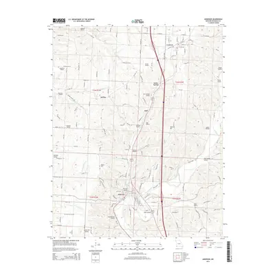
2015 Map of Anderson
USGS Topo · Published 2015About this map
The community of Goodman sits atop the high ground in the northeast, while the town of Anderson anchors the lower terrain near the confluence of local tributaries. This corner of the Ozark plateau is defined by a complex drainage network, where the waters of Indian Creek and Beaver Br have carved numerous steep-sided valleys into the landscape. These "hollows," such as Honey Lake Hollow, Thief Hollow, and Charleton Hollow, serve as the primary topographic features, dictating the placement of roads and small settlements like Splitlog and Elliff.
Find a feature on this map
142 named features on this map. Tap any name to fly to it.
Don’t see what you’re looking for? This feature index may not catch every label — zoom into the map to look around manually.
Map Details
Editions of this 2015 Anderson Map
This is the sole edition of this map. No revisions or reprints were ever made.
Other maps of this area

1907 · Wyandotte
USGS Topo · 1:125,000

1909 · Wyandotte
USGS Topo · 1:125,000

1916 · Neosho
USGS Topo · 1:62,500

1940 · Noel
USGS Topo · 1:62,500

1943 · Noel
USGS Topo · 1:62,500

1949 · Seneca
USGS Topo · 1:24,000

1950 · Seneca
USGS Topo · 1:24,000

1954 · Tulsa
USGS Topo · 1:250,000

1958 · Tulsa
USGS Topo · 1:250,000

1963 · Tulsa
USGS Topo · 1:250,000