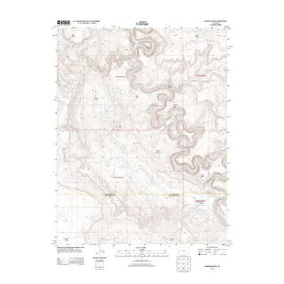
2013 Map of Anderson Mesa
USGS Topo · Published 2013About this map
The Dolores River carves a deep, winding path through the high desert landscape of Montrose and San Miguel Counties, defining the geography of this 2013 survey. The river's dramatic oxbow at Muleshoe Bend and the presence of the Dolores River Arch highlight the erosive power that has shaped the surrounding mesas. High plateaus like Anderson Mesa and Ray Mesa rise above the drainage systems of Coyote Wash and Little Gypsum Cr, where early water management is evidenced by the Muleshoe Bend Reservoir.
Find a feature on this map
32 named features on this map. Tap any name to fly to it.
Don’t see what you’re looking for? This feature index may not catch every label — zoom into the map to look around manually.
Map Details
Editions of this 2013 Anderson Mesa Map
This is the sole edition of this map. No revisions or reprints were ever made.
Other maps of this area

1885 · La Sal
USGS Topo · 1:250,000

1916 · Paradox Valley
USGS Topo · 1:125,000

1922 · Paradox Valley
USGS Topo · 1:125,000

1948 · Bull Canyon
USGS Topo · 1:24,000

1948 · Horse Range Mesa
USGS Topo · 1:24,000

1948 · Hamm Canyon
USGS Topo · 1:24,000

1948 · Paradox
USGS Topo · 1:24,000

1949 · Bull Canyon
USGS Topo · 1:24,000

1949 · Davis Mesa
USGS Topo · 1:24,000

1949 · Paradox
USGS Topo · 1:24,000