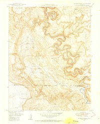
1949 Map of Anderson Mesa
USGS Topo · Published 1955About this map
The Dolores River carves a dramatic, winding path through this Colorado landscape, featuring the sharp horseshoe turn at Muleshoe Bend. This 1949 field-checked survey reveals an area defined by its mineral prospects and topographic extremes, where the border of Montrose and San Miguel counties cuts across the high plateaus of Anderson Mesa and Skein Mesa. Early mid-century uranium and vanadium exploration is evident through the presence of Morning Star Mine, The Raven Mine, and the Gyp Mine located near Little Gypsum Valley. The map detail shows essential water sources for cattle and mining in this arid environment, such as Skein Spring Reservoir and East Island Mesa Spring. Notable landmarks like The Hat and Silveys Pocket provide distinct navigational points within the complex canyon and wash systems.
Find a feature on this map
23 named features on this map. Tap any name to fly to it.
Don’t see what you’re looking for? This feature index may not catch every label — zoom into the map to look around manually.
Map Details
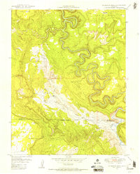
Editions of this 1949 Anderson Mesa Map
2 editions found
Other maps of this area

1885 · La Sal
USGS Topo · 1:250,000

1916 · Paradox Valley
USGS Topo · 1:125,000

1922 · Paradox Valley
USGS Topo · 1:125,000

1948 · Bull Canyon
USGS Topo · 1:24,000

1948 · Horse Range Mesa
USGS Topo · 1:24,000

1948 · Hamm Canyon
USGS Topo · 1:24,000

1948 · Paradox
USGS Topo · 1:24,000

1949 · Bull Canyon
USGS Topo · 1:24,000

1949 · Davis Mesa
USGS Topo · 1:24,000

1949 · Paradox
USGS Topo · 1:24,000