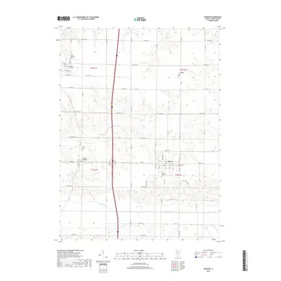
2018 Map of Andover
USGS Topo · Published 2018About this map
Andover and Orion anchor this corner of Henry County, illustrating a landscape defined by traditional Midwestern town plats and a network of rural cemeteries. The area's genealogical history is well-preserved through sites like the Orion Lutheran Cem, Lynn Center Cem, and the Andover Township Cem. These settlements developed along the high ground between the watercourses of Camp Cr and the Edwards River, which meanders across the southern portion of the map. The spatial arrangement of the towns, particularly the grid of Andover, shows the deliberate planning of early 19th-century communities in Illinois. Local connectivity is maintained by a dense grid of range roads, including Co Hwy 19 and Co Hwy 32, while smaller waterways like Mud Cr and Mosquito Cr drain the surrounding agricultural lands.
Find a feature on this map
44 named features on this map. Tap any name to fly to it.
Don’t see what you’re looking for? This feature index may not catch every label — zoom into the map to look around manually.
Map Details
Editions of this 2018 Andover Map
This is the sole edition of this map. No revisions or reprints were ever made.
Other maps of this area

1931 · Galva
USGS Topo · 1:48,000

1934 · Geneseo
USGS Topo · 1:62,500

1937 · Orion
USGS Topo · 1:62,500

1940 · Galva
USGS Topo · 1:62,500

1944 · Galva
USGS Topo · 1:62,500

1947 · Woodhull
USGS Topo · 1:62,500

1949 · Coal Valley
USGS Topo · 1:24,000
1953 · Coal Valley
USGS Topo · 1:24,000

1953 · Nekoma
USGS Topo · 1:24,000

1953 · Woodhull
USGS Topo · 1:24,000