
1953 Map of Woodhull
USGS Topo · Published 1957About this map
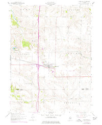
Woodhull serves as the central hub of this agricultural landscape, situated at the junction of the Chicago Burlington and Quincy railroad and a primary state route. The map documents a well-established social fabric, from the Alwood High School in town to rural religious anchors like Bethany Church and Clover Chapel Church. The terrain is defined by the winding paths of Mud Creek and Pope Creek, which cut through the townships of Lynn, Andover, Oxford, and Clover. Several burial grounds, including Summit Level Cemetery and St Johns Cemetery, are clearly marked, providing valuable location data for genealogists tracing families along the Henry County and Knox County border. This survey represents the mid-century peak of these farming communities just as modern infrastructure began to consolidate around the village center.
Find a feature on this map
19 named features on this map. Tap any name to fly to it.
Don’t see what you’re looking for? This feature index may not catch every label — zoom into the map to look around manually.
Map Details
Editions of this 1953 Woodhull Map
2 editions found
Other maps of this area

1931 · Galva
USGS Topo · 1:48,000

1934 · Geneseo
USGS Topo · 1:62,500

1937 · Orion
USGS Topo · 1:62,500

1940 · Galva
USGS Topo · 1:62,500

1944 · Galva
USGS Topo · 1:62,500

1947 · Woodhull
USGS Topo · 1:62,500

1953 · Nekoma
USGS Topo · 1:24,000
1953 · Andover
USGS Topo · 1:24,000
1953 · New Windsor
USGS Topo · 1:24,000
1953 · Cambridge
USGS Topo · 1:24,000