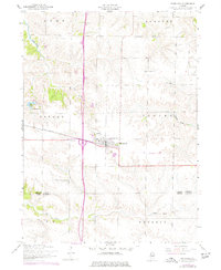
1953 Map of Woodhull
USGS Topo · Published 1977About this map
Woodhull serves as the central hub of this Illinois prairie landscape, situated where the Chicago Burlington and Quincy railroad line meets the developing interstate corridor. The town’s social and educational fabric is anchored by Alwood High School and Bethany Church, while the surrounding countryside is dotted with historic markers of local heritage such as Clover Chapel Church and St Johns Cemetery. This 1953 survey, updated with 1970s revisions, illustrates a transition in rural transport as the Old Railroad Grade appears alongside modernized roadways.
Find a feature on this map
24 named features on this map. Tap any name to fly to it.
Don’t see what you’re looking for? This feature index may not catch every label — zoom into the map to look around manually.
Map Details
Editions of this 1953 Woodhull Map
2 editions found
Other maps of this area

1931 · Galva
USGS Topo · 1:48,000

1934 · Geneseo
USGS Topo · 1:62,500

1937 · Orion
USGS Topo · 1:62,500

1940 · Galva
USGS Topo · 1:62,500

1944 · Galva
USGS Topo · 1:62,500

1947 · Woodhull
USGS Topo · 1:62,500

1953 · Nekoma
USGS Topo · 1:24,000

1953 · Woodhull
USGS Topo · 1:24,000
1953 · Andover
USGS Topo · 1:24,000
1953 · New Windsor
USGS Topo · 1:24,000