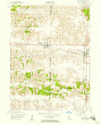
1953 Map of New Windsor
USGS Topo · Published 1957About this map
Agricultural plains and coal-rich corners define this mid-century look at the border of Mercer, Henry, and Knox Counties. The village of New Windsor (Windsor) serves as a primary hub, organized along the east-west corridor of the Chicago Burlington and Quincy railroad. To the east, the village of Alpha sits near the Alpha Coal Mine (abandoned), where prominent tailings piles signify the area's industrial past. A dispersed rural social infrastructure is evident through numerous country schoolhouses, including Hopewell School, Oakridge School, and Maple Ridge School, most of which were phased out as education consolidated toward larger centers like the Atwood Junior High School. Waterways such as North Pope Creek and Pope Creek cut through the landscape, flanked by timbered tracts that break up the grid of section lines and gravel roads like Knoxville Road.
Find a feature on this map
29 named features on this map. Tap any name to fly to it.
Don’t see what you’re looking for? This feature index may not catch every label — zoom into the map to look around manually.
Map Details
Editions of this 1953 New Windsor Map
2 editions found
Other maps of this area

1912 · Milan
USGS Topo · 1:62,500

1923 · Alexis
USGS Topo · 1:62,500

1925 · Alexis
USGS Topo · 1:62,500

1937 · Orion
USGS Topo · 1:62,500

1944 · Milan
USGS Topo · 1:62,500

1947 · Woodhull
USGS Topo · 1:62,500

1953 · Woodhull
USGS Topo · 1:24,000

1953 · Viola
USGS Topo · 1:24,000
1953 · Andover
USGS Topo · 1:24,000
1953 · Matherville
USGS Topo · 1:24,000