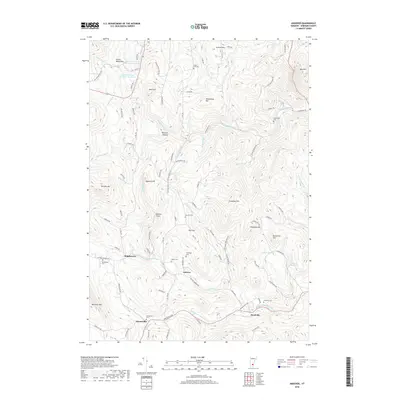
2018 Map of Andover
USGS Topo · Published 2018About this map
Andover and the surrounding Windsor County hills are defined by a network of steep ridgelines and the winding courses of the Williams River and the Middle Br Williams River. Small settlements such as Middletown, Simonsville, and Reedville are clustered along these narrow valley floors and historic road corridors. The landscape is dotted with several family and community burial grounds, including the Heald Cem, Pettengill Cem, and Simonsville Cem, providing a clear record of local genealogy. In addition to these traditional rural features, the map shows 20th-century water management and transportation additions like the Chester Reservoir, Jewell Brook Site Number 1 Reservoir, and the small Holloway Airport. The topography reaches significant elevations at Terrible Mtn and Markham Mtn, overlooking the many brooks that feed the river system below.
Find a feature on this map
100 named features on this map. Tap any name to fly to it.
Don’t see what you’re looking for? This feature index may not catch every label — zoom into the map to look around manually.
Map Details
Editions of this 2018 Andover Map
This is the sole edition of this map. No revisions or reprints were ever made.
Other maps of this area

1893 · Wallingford
USGS Topo · 1:62,500

1894 · Londonderry
USGS Topo · 1:62,500

1899 · Londonderry
USGS Topo · 1:62,500

1928 · Ludlow
USGS Topo · 1:48,000

1929 · Ludlow
USGS Topo · 1:62,500

1930 · Saxtons River
USGS Topo · 1:48,000

1932 · Ludlow
USGS Topo · 1:62,500

1933 · Saxtons River
USGS Topo · 1:62,500

1950 · Glens Falls
USGS Topo · 1:250,000

1955 · Wallingford
USGS Topo · 1:62,500