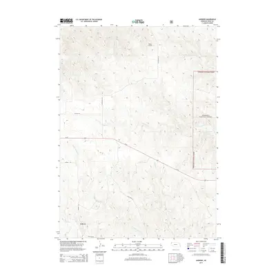
2014 Map of Andrews
USGS Topo · Published 2014About this map
The settlement of Andrews sits in the southwestern corner of this Sioux County survey, positioned near the headwaters of the White River. The landscape is defined by the drainage systems of the High Plains, where seasonal waterways like Soldier Spring Cr and Buck Cr carve through the terrain. To the north, Beans Canyon provides a distinct geographic break in the elevation, while Cottonwood Rd serves as a primary north-south corridor across the western half of the map.
Find a feature on this map
15 named features on this map. Tap any name to fly to it.
Don’t see what you’re looking for? This feature index may not catch every label — zoom into the map to look around manually.
Map Details
Editions of this 2014 Andrews Map
This is the sole edition of this map. No revisions or reprints were ever made.
Other maps of this area

1955 · Alliance
USGS Topo · 1:250,000

1957 · Alliance
USGS Topo · 1:250,000

1958 · Alliance
USGS Topo · 1:250,000

1979 · Harrison SE
USGS Topo · 1:24,000

1979 · Harrison East
USGS Topo · 1:24,000

1980 · Kyle Creek
USGS Topo · 1:24,000

1980 · Smiley Canyon
USGS Topo · 1:24,000

1980 · Five Points
USGS Topo · 1:24,000

1980 · Andrews
USGS Topo · 1:24,000
1980 · Roundtop
USGS Topo · 1:24,000