
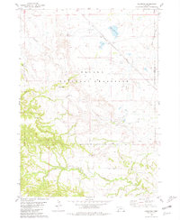
1980 Map of Smiley Canyon
USGS Topo · Published 1981About this map
Conservation and military history intersect in this portion of Sioux County, where the sprawling Fort Robinson State Park and Fort Robinson State Wildlife Area dominate the eastern landscape. The area is defined by the sharp transitions of the High Plains, featuring the namesake Smiley Canyon and the headwaters of the Soldier Creek network. The Nebraska National Forest (Soldier Creek Management Unit) covers the western half of the map, illustrating the significant commitment to public land management and natural resource protection in the Nebraska Panhandle.
Find a feature on this map
14 named features on this map. Tap any name to fly to it.
Don’t see what you’re looking for? This feature index may not catch every label — zoom into the map to look around manually.
Map Details
Editions of this 1980 Smiley Canyon Map
This is the sole edition of this map. No revisions or reprints were ever made.
Other maps of this area

1955 · Alliance
USGS Topo · 1:250,000

1957 · Alliance
USGS Topo · 1:250,000

1958 · Alliance
USGS Topo · 1:250,000

1980 · Horn
USGS Topo · 1:24,000

1980 · Kyle Creek
USGS Topo · 1:24,000

1980 · Five Points
USGS Topo · 1:24,000

1980 · Andrews
USGS Topo · 1:24,000
1980 · Roundtop
USGS Topo · 1:24,000

1980 · Dead Mans Creek
USGS Topo · 1:24,000
1980 · Crawford
USGS Topo · 1:24,000