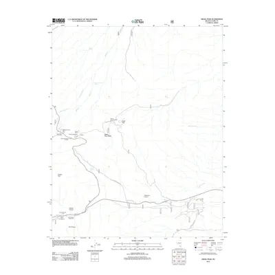
2012 Map of Angel Peak
USGS Topo · Published 2012About this map
Angel Peak and Fletcher Peak dominate this high-altitude landscape in the Spring Mountains, where deep incisions like Telephone Canyon and Pine Canyon define the topography. The area is a significant recreational hub, featuring a dense concentration of facilities such as the Mahogany Grove Picnic Area, Hilltop Campground, and the Kyle Canyon Campground. Roadways including Telephone Canyon Rd and Harris Spring Rd provide access to these elevations, while the Mount Charleston North Trailhead serves as a gateway for mountain exploration. Several water sources, including Goodwater Spring and Sidehill Spring, are vital markers in this arid environment. The presence of the Spring Mountain Youth Camp and the Kyle Canyon RV Camp highlights the modern residential and seasonal usage of these mountain canyons, providing a detailed look at the interface between managed forest lands and developed infrastructure.
Find a feature on this map
22 named features on this map. Tap any name to fly to it.
Don’t see what you’re looking for? This feature index may not catch every label — zoom into the map to look around manually.
Map Details
Editions of this 2012 Angel Peak Map
This is the sole edition of this map. No revisions or reprints were ever made.
Other maps of this area

1907 · Las Vegas
USGS Topo · 1:250,000

1908 · Las Vegas
USGS Topo · 1:250,000

1952 · Corn Creek Springs
USGS Topo · 1:62,500

1952 · Blue Diamond
USGS Topo · 1:62,500

1954 · Las Vegas
USGS Topo · 1:250,000

1957 · Las Vegas
USGS Topo · 1:250,000

1957 · Charleston Peak
USGS Topo · 1:62,500

1957 · Mountain Springs
USGS Topo · 1:62,500

1959 · Las Vegas
USGS Topo · 1:250,000

1962 · Las Vegas
USGS Topo · 1:250,000