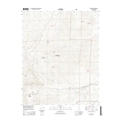
2014 Map of Angel Peak
USGS Topo · Published 2014About this map
Mount Charleston serves as a focal point for this 2014 survey of high-elevation terrain in the Toiyabe National Forest. The map documents a complex system of water sources and canyons, including Lower Deer Creek Spring and Sidehill Spring, which are critical in this arid environment. The landscape is defined by its extreme vertical relief, featuring Angel Peak and Fletcher Peak alongside prominent lookouts like Desert View Point. Transport and access routes such as Kyle Canyon Rd and Telephone Canyon Rd provide a sense of how this portion of the Mojave Desert is navigated. Local history and geography enthusiasts can trace the intersection of mountain topography with specific natural landmarks like Lucky Strike Canyon and Pine Canyon.
Find a feature on this map
25 named features on this map. Tap any name to fly to it.
Don’t see what you’re looking for? This feature index may not catch every label — zoom into the map to look around manually.
Map Details
Editions of this 2014 Angel Peak Map
This is the sole edition of this map. No revisions or reprints were ever made.
Other maps of this area

1907 · Las Vegas
USGS Topo · 1:250,000

1908 · Las Vegas
USGS Topo · 1:250,000

1952 · Corn Creek Springs
USGS Topo · 1:62,500

1952 · Blue Diamond
USGS Topo · 1:62,500

1954 · Las Vegas
USGS Topo · 1:250,000

1957 · Las Vegas
USGS Topo · 1:250,000

1957 · Charleston Peak
USGS Topo · 1:62,500

1957 · Mountain Springs
USGS Topo · 1:62,500

1959 · Las Vegas
USGS Topo · 1:250,000

1962 · Las Vegas
USGS Topo · 1:250,000