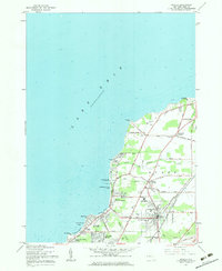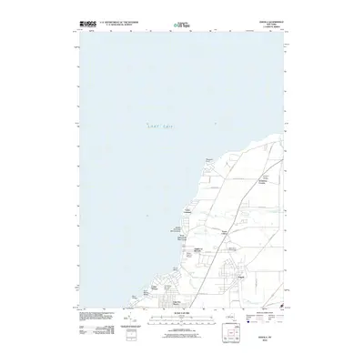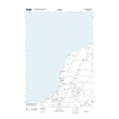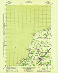
1944 Map of Angola
USGS Topo · Published 1944About this map
The town of Angola serves as a central hub on this 1944 War Department survey, where three major rail lines—the Pennsylvania, Nickel Plate, and New York Central—converge to navigate the coastal terrain of Erie County. This wartime era documentation highlights a landscape transitioning from rural agricultural tracts to established lakeshore communities. The shoreline along Lake Erie is densely marked with summer settlements and public spaces, including the Buffalo Municipal Bathing Beach and the residential clusters of Angola on the Lake and Lake Erie Beach.
Find a feature on this map
43 named features on this map. Tap any name to fly to it.
Don’t see what you’re looking for? This feature index may not catch every label — zoom into the map to look around manually.
Map Details
Editions of this 1944 Angola Map
This is the sole edition of this map. No revisions or reprints were ever made.
Historical Maps of Evans Through Time
7 maps found