
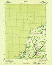
1943 Map of Silver Creek
USGS Topo · Published 1953About this map
Silver Creek serves as the focal point of this coastal landscape, situated where the village meets the southern shores of Lake Erie. The 1943 topography reveals a dense corridor of transportation along the lakefront, where the New York Central and Hudson River Railroad, the Nickel Plate Road, and the Pennsylvania Railroad parallel the shoreline. This industrial backbone is contrasted by the resort-oriented character of the coast, featuring Lotus Point, Millers Beach, and Sunset Bay Park.
Find a feature on this map
36 named features on this map. Tap any name to fly to it.
Don’t see what you’re looking for? This feature index may not catch every label — zoom into the map to look around manually.
Map Details
Editions of this 1943 Silver Creek Map
This is the sole edition of this map. No revisions or reprints were ever made.
Other maps of this area

1899 · Silver Creek
USGS Topo · 1:62,500

1900 · Dunkirk
USGS Topo · 1:62,500

1900 · Cherry Creek
USGS Topo · 1:62,500

1941 · Cherry Creek
USGS Topo · 1:62,500

1943 · Dunkirk
USGS Topo · 1:62,500
1944 · Angola
USGS Topo · 1:31,680

1944 · Farnham
USGS Topo · 1:31,680

1944 · Silver Creek
USGS Topo · 1:31,680

1954 · Forestville
USGS Topo · 1:24,000
1954 · Perrysburg
USGS Topo · 1:24,000