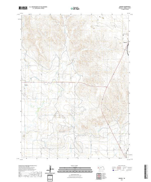
2021 Map of Angora
USGS Topo · Published 2021About this map
Angora and the small settlement of Perrin anchor this portion of Morrill County, where the high plains landscape is defined by an intricate network of early 20th-century irrigation infrastructure. The agricultural character of the region is evident in the presence of the Tri-State Canal, Lowline Canal, and Northport Canal, which cut across the terrain to manage water resources in this arid environment. These man-made waterways supplement natural drainages like Red Willow Cr and W Water Cr, illustrating the intensive engineering required to sustain local ranching and farming. Local history and genealogy researchers will find the Angora Cem located north of the townsite, providing a primary reference point for the community's heritage. The map also traces a dense grid of rural routes, including Co RD 110 and RD 106, which connected isolated homesteads to the rail-adjacent hubs of the Nebraska Panhandle.
Find a feature on this map
32 named features on this map. Tap any name to fly to it.
Don’t see what you’re looking for? This feature index may not catch every label — zoom into the map to look around manually.
Map Details
Editions of this 2021 Angora Map
This is the sole edition of this map. No revisions or reprints were ever made.
Other maps of this area

1898 · Camp Clarke
USGS Topo · 1:125,000

1954 · Scottsbluff
USGS Topo · 1:250,000

1958 · Scottsbluff
USGS Topo · 1:250,000

1965 · Bayard
USGS Topo · 1:24,000

1965 · Bridgeport NW
USGS Topo · 1:24,000
1965 · Bayard NE
USGS Topo · 1:24,000

1965 · Angora SE
USGS Topo · 1:24,000

1965 · South Bayard
USGS Topo · 1:24,000
1965 · Angora NE
USGS Topo · 1:24,000
1965 · Angora NW
USGS Topo · 1:24,000