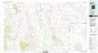
1983 Map of Animas
USGS Topo · Published 1983About this map
The Continental Divide winds through the high desert basins of the Bootheel region in the early 1980s, marking a landscape defined by isolated mountain ranges and broad valleys. This arid frontier is punctuated by the vast Playas Lake and the rugged peaks of the Peloncillo Mountains and Big Hatchet Mountains. The mapping reveals a distinct pattern of land use where cattle ranching and mining operations like the International Mine and Gillespie Mine anchor the sparse population.
Find a feature on this map
44 named features on this map. Tap any name to fly to it.
Don’t see what you’re looking for? This feature index may not catch every label — zoom into the map to look around manually.
Map Details
Editions of this 1983 Animas Map
This is the sole edition of this map. No revisions or reprints were ever made.
Other maps of this area

1899 · Deming
USGS Topo · 1:125,000

1915 · Deming
USGS Topo · 1:125,000

1917 · Hermanas
USGS Topo · 1:62,500

1917 · San Simon
USGS Topo · 1:125,000

1917 · Chiricahua
USGS Topo · 1:125,000

1917 · Antelope Wells
USGS Topo · 1:62,500

1918 · Big Hatchet Peak
USGS Topo · 1:62,500

1918 · Hachita
USGS Topo · 1:62,500

1918 · Hermanas
USGS Topo · 1:62,500

1918 · Dog Mountains
USGS Topo · 1:62,500