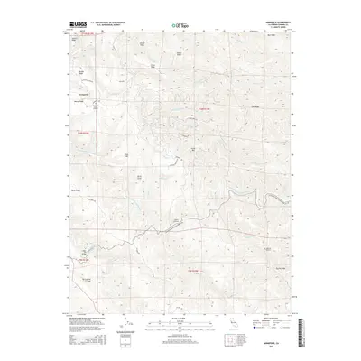
2015 Map of Annapolis
USGS Topo · Published 2015About this map
Annapolis sits within the ridge-and-canyon terrain of northwestern Sonoma County, where the San Andreas Fault cuts a distinct line through the southwestern landscape. The topography is defined by a dense network of watercourses, most notably the Wheatfield Fork Gualala River and the South Fork Gualala River, which drain through deep valleys separated by family-named heights such as John W Ridge and Evans Ridge. This 2015 survey illustrates a landscape of large-scale land divisions and winding mountain roads like Stewarts Point Skaggs Springs Rd. Local history is anchored by the Annapolis Church Cemetery and Sugarloaf Cemetery, while the Clipper Mill Bridge and the small settlement at Clarks Crossing indicate historically significant transit points across the river forks. These features, along with prominent summits like Fuller Mtn, provide a detailed record of the region's rural character and geological features.
Find a feature on this map
51 named features on this map. Tap any name to fly to it.
Don’t see what you’re looking for? This feature index may not catch every label — zoom into the map to look around manually.
Map Details
Editions of this 2015 Annapolis Map
This is the sole edition of this map. No revisions or reprints were ever made.
Other maps of this area

1921 · Skaggs
USGS Topo · 1:62,500

1921 · Plantation
USGS Topo · 1:62,500

1938 · Hopland
USGS Topo · 1:62,500

1943 · Tombs Creek
USGS Topo · 1:24,000

1943 · Stewarts Point
USGS Topo · 1:24,000

1943 · Plantation
USGS Topo · 1:24,000

1943 · Annapolis
USGS Topo · 1:24,000

1943 · Fort Ross
USGS Topo · 1:24,000

1943 · Hopland
USGS Topo · 1:62,500

1943 · Ornbaun
USGS Topo · 1:62,500