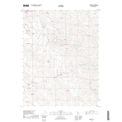
2018 Map of Annapolis
USGS Topo · Published 2018About this map
The ridge-and-canyon topography of northwestern Sonoma County defines this 2018 survey, centered on the community of Annapolis. The landscape is dominated by the complex drainage systems of the Wheatfield-Fork Gualala River and the South Fork Gualala River, which carve deep valleys between high points like Fuller Mtn and Nob Hill. Traces of the region's geological and industrial history are evident in the path of the San Andreas Fault crossing the southwest corner and the presence of the Clipper Mill Bridge over the river. Many landmarks bear the names of early settlers and landowners, preserved through features such as John West Ridge, Evans Ridge, and Miller Ridge. The map also records vital community sites, including the Annapolis Church Cem and Sugarloaf Cem, providing a detailed look at the rural road network connecting these remote points, from Stewarts Point-Skaggs Springs Rd to Tin Barn Rd.
Find a feature on this map
68 named features on this map. Tap any name to fly to it.
Don’t see what you’re looking for? This feature index may not catch every label — zoom into the map to look around manually.
Map Details
Editions of this 2018 Annapolis Map
This is the sole edition of this map. No revisions or reprints were ever made.
Other maps of this area

1921 · Skaggs
USGS Topo · 1:62,500

1921 · Plantation
USGS Topo · 1:62,500

1938 · Hopland
USGS Topo · 1:62,500

1943 · Tombs Creek
USGS Topo · 1:24,000

1943 · Stewarts Point
USGS Topo · 1:24,000

1943 · Plantation
USGS Topo · 1:24,000

1943 · Annapolis
USGS Topo · 1:24,000

1943 · Fort Ross
USGS Topo · 1:24,000

1943 · Hopland
USGS Topo · 1:62,500

1943 · Ornbaun
USGS Topo · 1:62,500