
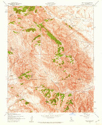
1943 Map of Annette
USGS Topo · Published 1943About this map
High ridges of the Temblor Range and Diablo Range dominate this 1943 survey of the California interior, capturing a landscape defined by ranching and the transit of the Antelope Valley. The settlement of Annette sits near a prominent Lookout Tower, serving as a central point for the remote canyons and passes. This era of land use is clearly visible through numerous family-named homesteads and holdings, such as Carters Ranch, Jack Ranch, and the C Twisselmann residence.
Find a feature on this map
41 named features on this map. Tap any name to fly to it.
Don’t see what you’re looking for? This feature index may not catch every label — zoom into the map to look around manually.
Map Details
Editions of this 1943 Annette Map
This is the sole edition of this map. No revisions or reprints were ever made.
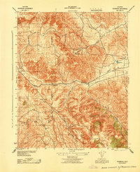
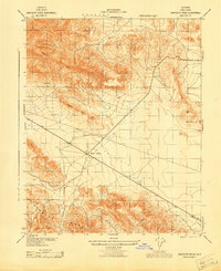
Other maps of this area

1914 · Cholame
USGS Topo · 1:125,000

1915 · Cholame
USGS Topo · 1:125,000

1917 · Cholame
USGS Topo · 1:125,000
1942 · Tent Hills
USGS Topo · 1:24,000
1943 · Packwood
USGS Topo · 1:31,680

1943 · Grant Lake
USGS Topo · 1:31,680

1943 · Commatti Canyon
USGS Topo · 1:31,680

1943 · Cholame
USGS Topo · 1:31,680

1943 · Tent Hills
USGS Topo · 1:31,680
1943 · Sawtooth Ridge
USGS Topo · 1:31,680