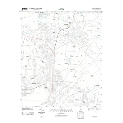
2011 Map of Anniston
USGS Topo · Published 2011About this map
Anniston anchors this 2011 survey, showing a landscape defined by industrial history and military presence in Calhoun County. The urban core is surrounded by a dense network of suburban and smaller residential developments, including Oxanna, Blue Mountain, and Pelham Heights. A unique historical feature of the area is the Prisoner of War Cemetery, located near Wygant Hill and Miller Hill. The topography is markedly varied, with the Skeleton Mountains and Blue Mountain Ridge providing a backdrop to the city's expansion. Aviation infrastructure is prominent through both McMinn-Airport and the Reilly AHP Airport. The map documents many significant local burial grounds, such as Hillside Cemetery and Highland Cemetery, which are essential for genealogical research in this part of Alabama. Water features like Cane Creek and Yahou Lake intersect the residential zones, illustrating the local drainage patterns near the city center.
Find a feature on this map
83 named features on this map. Tap any name to fly to it.
Don’t see what you’re looking for? This feature index may not catch every label — zoom into the map to look around manually.
Map Details
Editions of this 2011 Anniston Map
This is the sole edition of this map. No revisions or reprints were ever made.
Other maps of this area

1900 · Anniston
USGS Topo · 1:125,000

1947 · Oxford
USGS Topo · 1:24,000

1947 · Anniston
USGS Topo · 1:24,000

1947 · Jacksonville
USGS Topo · 1:24,000

1947 · Wellington
USGS Topo · 1:24,000

1947 · Jacksonville
USGS Topo · 1:62,500

1947 · Eulaton
USGS Topo · 1:24,000

1947 · Munford
USGS Topo · 1:24,000

1950 · Anniston
USGS Topo · 1:62,500

1953 · Atlanta
USGS Topo · 1:250,000