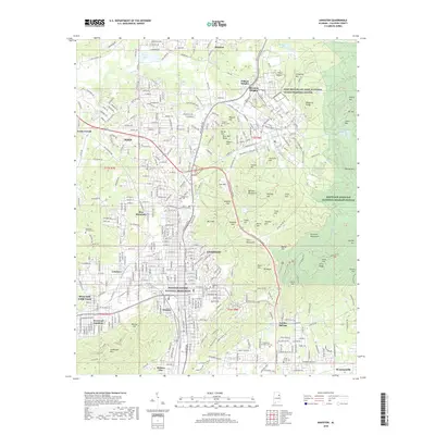
2018 Map of Anniston
USGS Topo · Published 2018About this map
Anniston and its surrounding communities are documented here as a complex landscape of military history, civil rights significance, and industrial heritage. The Freedom Riders National Monument stands as a central landmark in the city, marking a pivotal site in the American Civil Rights Movement. To the north, the sprawling Fort McClellan Army National Guard Training Center defines the geography of the hills, containing specialized sites like the Prisoner of War Cem.
Find a feature on this map
269 named features on this map. Tap any name to fly to it.
Don’t see what you’re looking for? This feature index may not catch every label — zoom into the map to look around manually.
Map Details
Editions of this 2018 Anniston Map
This is the sole edition of this map. No revisions or reprints were ever made.
Other maps of this area

1900 · Anniston
USGS Topo · 1:125,000

1947 · Oxford
USGS Topo · 1:24,000

1947 · Anniston
USGS Topo · 1:24,000

1947 · Jacksonville
USGS Topo · 1:24,000

1947 · Wellington
USGS Topo · 1:24,000

1947 · Jacksonville
USGS Topo · 1:62,500

1947 · Eulaton
USGS Topo · 1:24,000

1947 · Munford
USGS Topo · 1:24,000

1950 · Anniston
USGS Topo · 1:62,500

1953 · Atlanta
USGS Topo · 1:250,000