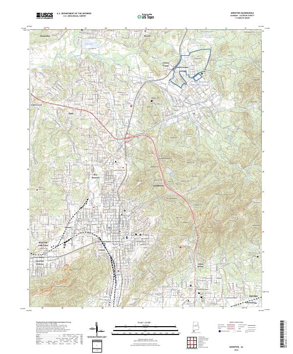
2024 Map of Anniston
USGS Topo · Published 2024About this map
Anniston and its neighboring communities of Saks, Blue Mountain, and Oxford are set against a complex landscape of sharp ridges and industrial corridors. The city’s civil rights legacy is anchored by the Freedom Riders National Monument, while its military history is preserved through the sprawling NG Fort McClellan ARNG Tng Center and the Fort McClellan Post. The eastern terrain is dominated by the Mountain Longleaf National Wildlife Refuge, where the Skeleton Mountains and Baltzell Mountains rise sharply above the valley floor.
Find a feature on this map
188 named features on this map. Tap any name to fly to it.
Don’t see what you’re looking for? This feature index may not catch every label — zoom into the map to look around manually.
Map Details
Editions of this 2024 Anniston Map
This is the sole edition of this map. No revisions or reprints were ever made.
Other maps of this area

1900 · Anniston
USGS Topo · 1:125,000

1947 · Oxford
USGS Topo · 1:24,000

1947 · Anniston
USGS Topo · 1:24,000

1947 · Jacksonville
USGS Topo · 1:24,000

1947 · Wellington
USGS Topo · 1:24,000

1947 · Jacksonville
USGS Topo · 1:62,500

1947 · Eulaton
USGS Topo · 1:24,000

1947 · Munford
USGS Topo · 1:24,000

1950 · Anniston
USGS Topo · 1:62,500

1953 · Atlanta
USGS Topo · 1:250,000