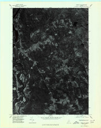
1975 Map of Anson NE
USGS Topo · Published 1980About this map
The Kennebec River carves a deep valley through the center of this Somerset County landscape, its banks defined by the braided channels and wooded islands near the settlement of Embden. This mid-1970s orthophoto survey reveals the rural character of the region, where the primary settlement at Solon serves as a focal point for the surrounding uplands. To the east, the terrain is marked by smaller outposts like South Solon and the intersection at Twelve Corners. The aerial photography clearly differentiates between the dense forest cover and the cleared agricultural fields that follow the winding path of Michael Stream. This specific record captures the intersection of river-bottom industry and remote hill farms before modern development patterns altered the traditional layout of these Maine townships.
Find a feature on this map
6 named features on this map. Tap any name to fly to it.
Don’t see what you’re looking for? This feature index may not catch every label — zoom into the map to look around manually.
Map Details
Editions of this 1975 Anson NE Map
This is the sole edition of this map. No revisions or reprints were ever made.
Other maps of this area

1903 · Bingham
USGS Topo · 1:62,500

1904 · Anson
USGS Topo · 1:62,500

1905 · Bingham
USGS Topo · 1:62,500

1913 · Skowhegan
USGS Topo · 1:62,500

1948 · Bangor
USGS Topo · 1:250,000

1948 · Kingsbury
USGS Topo · 1:62,500

1950 · Kingsbury
USGS Topo · 1:62,500

1954 · Millinocket
USGS Topo · 1:250,000

1955 · Anson
USGS Topo · 1:62,500

1955 · Skowhegan
USGS Topo · 1:62,500