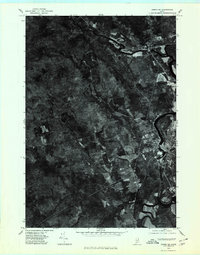
1976 Map of Anson SW
USGS Topo · Published 1980About this map
Carrabassett River and Kennebec River converge in this orthophotoquad, illustrating the hydraulic geography of Somerset County in the mid-1970s. The aerial imagery highlights the concentration of development along the eastern riverbanks, where North Anson, Anson, and Madison form a chain of riverfront settlements. Beyond the populated corridors, the landscape transitions into a vast expanse of timberland and agriculture, broken only by rural intersections like Five Corners. This orthophotograph, prepared by the Geological Survey from 1976 aerial photography, provides a rare visual record of land use and forest cover before decades of modern growth. Researchers can trace the path of Sandy Brook as it winds through the southern reaches, providing a clear view of the natural drainage patterns that shaped the region's early rural development.
Find a feature on this map
7 named features on this map. Tap any name to fly to it.
Don’t see what you’re looking for? This feature index may not catch every label — zoom into the map to look around manually.
Map Details
Editions of this 1976 Anson SW Map
This is the sole edition of this map. No revisions or reprints were ever made.
Other maps of this area

1894 · Norridgewock
USGS Topo · 1:62,500

1898 · Norridgewock
USGS Topo · 1:62,500

1904 · Anson
USGS Topo · 1:62,500

1924 · Farmington
USGS Topo · 1:62,500

1930 · Kingfield
USGS Topo · 1:48,000

1932 · Kingfield
USGS Topo · 1:62,500

1943 · Norridgewock
USGS Topo · 1:62,500

1948 · Bangor
USGS Topo · 1:250,000

1950 · Lewiston
USGS Topo · 1:250,000

1955 · Anson
USGS Topo · 1:62,500