2023 Map of Ansonia
USGS Topo · Published 2023About this map
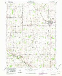
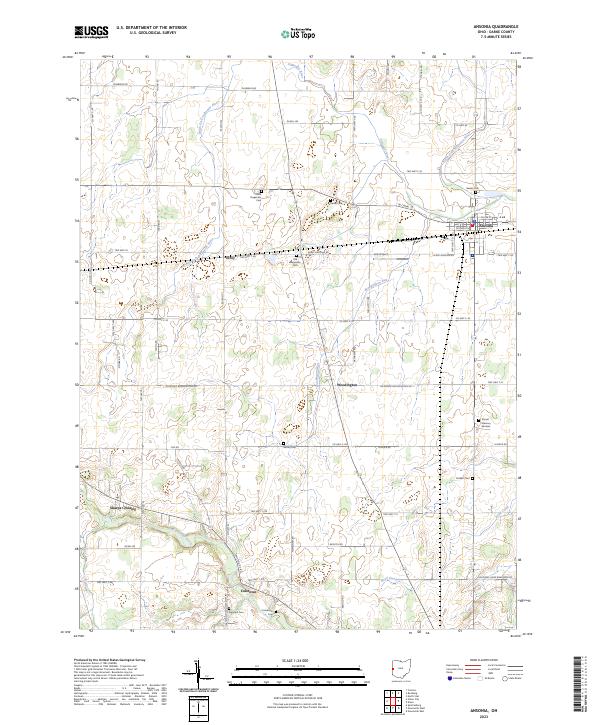
Ansonia serves as the primary hub in this portion of Darke County, situated at a junction where rail corridors once dictated the local economy. The surrounding landscape is defined by the hydrologic network of the Stillwater River and its various branches, including the South Fork Stillwater River and North Fork Stillwater River. This agricultural terrain is dotted with small rural settlements such as Woodington, Elroy, and Coletown, each maintaining its own distinct identity through local cemeteries and road intersections. Genealogists will find a high density of burial sites, ranging from the modern Sunset Memory Gardens to historic family plots like the New Teagarden Cem and Old Teagarden Cem. Small-scale aviation is represented by Leis Airport, while the southern reaches of the map are drained by Greenville Creek near the crossing at Sharps Crossing.
Find a feature on this map
39 named features on this map. Tap any name to fly to it.
Don’t see what you’re looking for? This feature index may not catch every label — zoom into the map to look around manually.
Map Details
Editions of this 2023 Ansonia Map
This is the sole edition of this map. No revisions or reprints were ever made.