Old Maps of Darke County, Ohio
Explore 117 old maps of Darke County, spanning from 1905 to today. These high-resolution historic maps reveal how streets, neighborhoods, landmarks, and natural features evolved over time — perfect for genealogy, metal detecting, research, and local history exploration.
What you can do with these maps:
- See how Darke County changed over time: Compare historical maps to modern-day views to trace roads, homesites, rail lines & more.
- View detailed metadata: Each map includes creators, publishers, year, scale, and archive source.
- Overlay maps with satellite & LiDAR: Visualize the past alongside modern tools to explore terrain & human change.
- Trusted historical sources: Maps sourced from the USGS, Library of Congress, and other archives.
- Access maps your way: View online, download high-res files, or order prints for personal or research use.
Start exploring old maps of Darke County to uncover forgotten places, hidden landmarks, and the deep history beneath your feet.
Darke County, OH maps
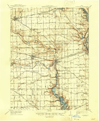
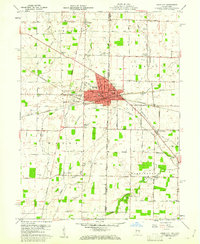
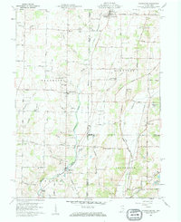
(117)- 1905 Map of Brookville, 1953 Print
 1905 Brookville1953 Print · USGSWestern Montgomery County in the early 1900s shows a landscape of rail-connected farming towns and early river management. Trace the path of the historic National Road through Arlington or locate family sites near Shiloh Church and Harshbarger Schoolhouse.
 - 1908 Map of St. Henry, 1944 Print
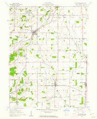
 1908 St. Henry1944 Print · USGSMercer and Darke counties at the start of the twentieth century show a landscape defined by rail-side commerce and early drainage engineering. Genealogists can trace family roots in settlements like St Henry, Burkettsville, and Coldwater, or locate landmarks such as Goulder School and Gilbert Sta.
 - 1909 Map of Loramie, 1961 Print
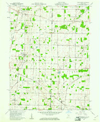
 1909 Loramie1961 Print · USGSWestern Ohio at the opening of the twentieth century was a landscape defined by the transition from canal transport to electric rail. Genealogists can trace family names across dozens of rural school districts like Walkup School and Diters School, or locate old parish centers such as Maria Stein and St John.
 - 1911 Map of Loramie, 1936 Print
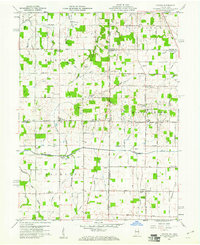
 1911 Loramie1936 Print · USGSWestern Ohio at the start of the twentieth century shows a landscape transitioning from the canal era to the age of electric rail. Researchers can trace the Miami and Erie Canal through Minster and New Bremen, or locate family sites near St Patricks Church and Schwaberow School.
 - 1911 Map of Covington, 1946 Print
 1911 Covington1946 Print · USGSWestern Ohio’s agricultural heartland is mapped here as a web of turnpikes and railroads connects thriving towns. Trace old family sites near Bradford, Gettysburg, and uniquely named rural landmarks like Lickskillet School or Cassels Corners.
 - 1915 Map of Fort Recovery
 1915 Fort Recovery1915 Print · USGSThe Indiana-Ohio borderlands come into focus during the mid-1910s, showing the agricultural and rail-dependent landscape around Fort Recovery. Genealogists and historians can trace the exact locations of numerous rural institutions like Oak Grove School, Mt Zion School, and the Lake Erie and Western railroad corridor.2 unique versions available
 - 1915 Map of New Paris
 1915 New Paris1915 Print · USGSThe Indiana-Ohio borderlands at the onset of the Great War reveal a landscape of thriving rail hubs and pioneer roads. Genealogists and researchers can trace the early layouts of Hollansburg, Campbellstown, and Sunbeam, or follow the path of the historic National Road.
 - 1916 Map of Winchester
 1916 Winchester1916 Print · USGSIndiana's eastern borderlands during the height of the interurban era show a landscape of thriving rail towns and rural school districts. Genealogists can locate specific landmarks like the County Infirmary, McKinley School, and the cross-border community of Union City.3 unique versions available
 - 1918 Map of Winchester
 1918 Winchester1918 Print · USGSRandolph County sits at a crossroads of major rail lines and headwater streams during the late nineteen-teens. Genealogists can locate dozens of country schoolhouses like McKinley School and Sauerkraut School, or trace family ties in Union City and Lynn.2 unique versions available
 - 1918 Map of Fort Recovery, 1922 Print
 1918 Fort Recovery1922 Print · USGSFort Recovery and the surrounding Mercer County farmsteads are documented here in the early twentieth century, just years after the turn of the century. Genealogists can trace family connections through a high density of rural schoolhouses like Mt Zion School and settlements such as Macedon and Buck Corners.
 - 1918 Map of New Paris, 1922 Print
 1918 New Paris1922 Print · USGSThe Indiana-Ohio border during the First World War reveals a landscape defined by pioneering electric railways and historic transit corridors. Genealogists and historians can trace the growth of New Paris and Hollansburg, or locate small communities like Sunbeam and Cedar Springs.
 - 1943 Map of Winchester, 1944 Print
 1943 Winchester1944 Print · USGSThe Indiana-Ohio borderlands in the 1940s reveal a landscape of bustling rail junctions and tight-knit rural school districts. Genealogists can trace family footprints at Beech Grove Sch, the County Infirmary, or the curious Sauerkraut Sch.
 - 1944 Map of Covington
 1944 Covington1944 Print · USGSWestern Ohio at the end of the Second World War remains a landscape of thriving rural rail towns and country schoolhouses. Researchers can trace the Stillwater River to find Greenville Falls, the Forest Hill Cem, and local landmarks like Tadpole Sch and Ludlow Falls.
 - 1944 Map of Loramie
 1944 Loramie1944 Print · USGSWest-central Ohio farmland is captured here during the mid-forties, showing the intricate grid of rural school districts and turnpikes. Researchers can trace family-named sites like Fledderjohn Sch and St Patricks Ch near the Loramie Reservoir.
 - 1953 Map of Cincinnati, 1965 Print
 1953 Cincinnati1965 Print · USGSThe Ohio River valley and the industrial heartland of Indiana and Ohio are captured here during the mid-century peak of rail and river commerce. Genealogists and historians can trace connections between Cincinnati and outlying military sites like Camp Atterbury and Bakalar AFB.3 unique versions available
 - 1953 Map of Muncie, 1966 Print
 1953 Muncie1966 Print · USGSIndiana and Ohio borderlands thrive in the early fifties, showing a landscape defined by manufacturing cities and an intensive railroad network. Genealogists can trace family roots across the Indiana-Ohio line through Muncie, Celina, and Portland via the Pennsylvania railroad.5 unique versions available
 - 1956 Map of Muncie
 1956 Muncie1956 Print · USGSEastern Indiana and western Ohio are shown at a peak of rail-driven industry in the mid-fifties. Genealogists and rail historians can trace the paths of the Pennsylvania RR through Muncie or locate landmarks like Lake Saint Marys (Grand Lake Reservoir) and Frances Slocum State Forest.
 - 1957 Map of Cincinnati
 1957 Cincinnati1957 Print · USGSThe Ohio River valley and its surrounding highlands thrived during the mid-fifties industrial peak, centered on the bustling Cincinnati and Dayton metropolitan hubs. Researchers can trace the extensive rail networks and military sites like Wright-Patterson AFB and Camp Atterbury.
 - 1960 Map of Union City, 1961 Print
 1960 Union City1961 Print · USGSThe Indiana-Ohio border communities are captured here in the early sixties, centered on the bustling rail junction of Union City. Researchers can trace old family sites at Spring Hill Cem, Poplar Grove Ch, and the rural crossroads of New Lisbon.4 unique versions available
 - 1960 Map of New Madison, 1961 Print
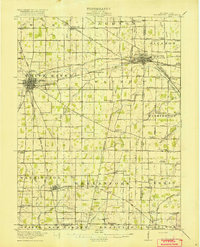
 1960 New Madison1961 Print · USGSWestern Darke County was a busy intersection of rail and agriculture in the early sixties. Genealogists and local historians can trace family land via New Madison, locate the Township Sch, or find ancestors at Greenmound Cem and Otterbine Cem.3 unique versions available
 - 1960 Map of Spartanburg, 1961 Print
 1960 Spartanburg1961 Print · USGSThe Indiana-Ohio borderlands at the start of the 1960s reveal a landscape of well-ordered farms and quiet railroad hamlets. Researchers can locate family landmarks like Beech Cemetery and Bartonia Cemetery or trace the New York Central through Crete.2 unique versions available
 - 1960 Map of Cosmos, 1961 Print
 1960 Cosmos1961 Print · USGSThe Indiana-Ohio borderlands at the start of the sixties were a grid of productive farmland and small rural parishes. Researchers can trace ancestral sites and local landmarks like Salem, Raper Chapel, and Mt Zion Cem Ch across the state line.4 unique versions available
 - 1960 Map of Whitewater, 1961 Print
 1960 Whitewater1961 Print · USGSThe Indiana-Ohio borderlands at the start of the sixties reveal a landscape of thriving crossroads and river-valley farms. Genealogists can trace family footprints through the Middleboro settlement, Friendship Ch, and several rural burial grounds like Bethel Cem.3 unique versions available
 - 1961 Map of Laura, 1962 Print
 1961 Laura1962 Print · USGSWestern Ohio farm country and quiet crossroads villages thrive in the early sixties across this multi-county border. Genealogists can trace family names through Mote Cem and Swank Cem or locate old homesteads near Potsdam and Pittsburg.2 unique versions available
 - 1961 Map of Dawn, 1962 Print
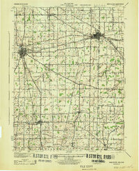
 1961 Dawn1962 Print · USGSDarke County agriculture and rail infrastructure are captured here in the early sixties as small crossroads communities thrived. Trace family lands and local landmarks like Stelvideo Cem, the Childrens Home, and the village of Beamsville.3 unique versions available
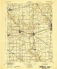
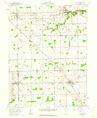
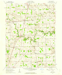
Showing maps 1-25 of 117
Top cities of Darke County
- Greenville historical maps
- Versailles historical maps
- Arcanum historical maps
- Union City historical maps
- Ansonia historical maps
- New Madison historical maps
See more
Frequently asked questions
- What are the different types of historical maps available for Darke County?
- What is the oldest map of Darke County?
- Where can I purchase historical maps of Darke County for my home or office?
- Where can I download high-res historical maps of Darke County?
- Are there historical topographic maps available for Darke County?
- Is there historical aerial imagery available for Darke County?
- Where are historical maps of Darke County sourced from?