1960s Maps of Darke County, Ohio
Explore 16 historic maps of Darke County from the 1960s. These maps offer a rare glimpse into what life looked like during the 1960s — showing old roads, neighborhoods, homes, and landmarks that have changed or disappeared over time.
Whether you're researching your family's past, planning a metal detecting trip, or studying how Darke County's landscape evolved across the 1960s, these high-resolution maps are a powerful tool for exploring the history of this region.
- Focus on a specific era: All maps on this page are from the 1960s, giving you a focused view of this time period.
- See what’s changed: Compare century-old streets, trails, and buildings to today's modern landscape using overlays and satellite layers.
- Research with precision: Use these maps for genealogy, historical research, land use analysis, or educational projects.
- View, download, or print: Maps are fully viewable online in high resolution, and can be downloaded or printed for your own records.
Start exploring Darke County's history through authentic maps from the 1960s. This is your window into the past.
Darke County, OH maps
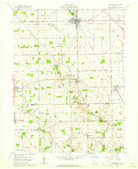
(16)- 1960 Map of Union City, 1961 Print
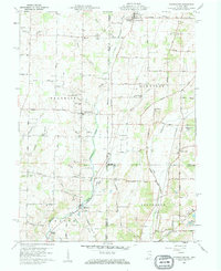
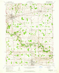
 1960 Union City1961 Print · USGSThe Indiana-Ohio border communities are captured here in the early sixties, centered on the bustling rail junction of Union City. Researchers can trace old family sites at Spring Hill Cem, Poplar Grove Ch, and the rural crossroads of New Lisbon.4 unique versions available
 - 1960 Map of New Madison, 1961 Print
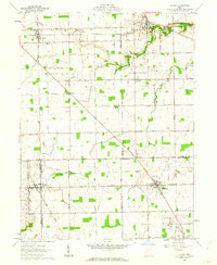
 1960 New Madison1961 Print · USGSWestern Darke County was a busy intersection of rail and agriculture in the early sixties. Genealogists and local historians can trace family land via New Madison, locate the Township Sch, or find ancestors at Greenmound Cem and Otterbine Cem.3 unique versions available
 - 1960 Map of Spartanburg, 1961 Print
 1960 Spartanburg1961 Print · USGSThe Indiana-Ohio borderlands at the start of the 1960s reveal a landscape of well-ordered farms and quiet railroad hamlets. Researchers can locate family landmarks like Beech Cemetery and Bartonia Cemetery or trace the New York Central through Crete.2 unique versions available
 - 1960 Map of Cosmos, 1961 Print
 1960 Cosmos1961 Print · USGSThe Indiana-Ohio borderlands at the start of the sixties were a grid of productive farmland and small rural parishes. Researchers can trace ancestral sites and local landmarks like Salem, Raper Chapel, and Mt Zion Cem Ch across the state line.4 unique versions available
 - 1960 Map of Whitewater, 1961 Print
 1960 Whitewater1961 Print · USGSThe Indiana-Ohio borderlands at the start of the sixties reveal a landscape of thriving crossroads and river-valley farms. Genealogists can trace family footprints through the Middleboro settlement, Friendship Ch, and several rural burial grounds like Bethel Cem.3 unique versions available
 - 1961 Map of Laura, 1962 Print
 1961 Laura1962 Print · USGSWestern Ohio farm country and quiet crossroads villages thrive in the early sixties across this multi-county border. Genealogists can trace family names through Mote Cem and Swank Cem or locate old homesteads near Potsdam and Pittsburg.2 unique versions available
 - 1961 Map of Dawn, 1962 Print
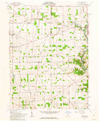
 1961 Dawn1962 Print · USGSDarke County agriculture and rail infrastructure are captured here in the early sixties as small crossroads communities thrived. Trace family lands and local landmarks like Stelvideo Cem, the Childrens Home, and the village of Beamsville.3 unique versions available
 - 1961 Map of Greenville East, 1962 Print
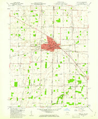
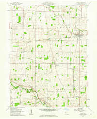
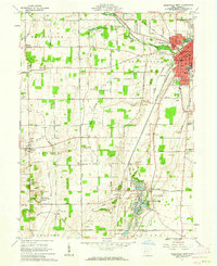
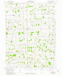
 1961 Greenville East1962 Print · USGSDarke County's rural landscape is captured here in the early sixties, showing the agricultural heartland of western Ohio. Genealogists and historians can trace family-named roads and rural landmarks like Bears Mill, the County Home Cem, and the village of Abbottsville.3 unique versions available
 - 1961 Map of Rossburg, 1962 Print
 1961 Rossburg1962 Print · USGSDarke and Mercer counties appear here in the early sixties, showing a landscape defined by small rail towns and the upper Stillwater River. Genealogists and local historians can trace New York Central rail stops and country landmarks like St Marys Novitiate and Zion Pilgrim Ch.2 unique versions available
 - 1961 Map of Versailles, 1962 Print
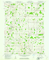
 1961 Versailles1962 Print · USGSThe rural crossroads of Darke, Shelby, and Miami counties come into focus during the early sixties, centered on the rail hubs of Versailles and Bradford. Researchers can trace old family sites and rural landmarks like St Peters Ch, St Valberts Cem, and the Childrens Home.2 unique versions available
 - 1961 Map of Ansonia, 1962 Print
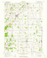
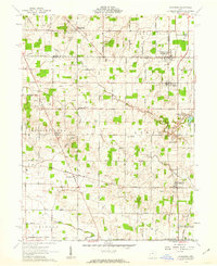
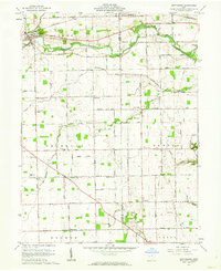
 1961 Ansonia1962 Print · USGSDarke County in the early sixties is a landscape defined by its rail junctions and agricultural corners. Genealogists can trace family roots at Old Teegarden Cemetery or locate old school sites like the Woodland Heights School.2 unique versions available
 - 1961 Map of Gettysburg, 1962 Print
 1961 Gettysburg1962 Print · USGSGettysburg and its neighboring townships in Darke and Miami counties are captured in the early 1960s, showing a landscape of productive farmland and small rural crossroads. Genealogists and local historians can trace family roots through sites like Newcomers Cem, Pattytown, and the German Ch.2 unique versions available
 - 1961 Map of Greenville West, 1962 Print
 1961 Greenville West1962 Print · USGSWestern Darke County in the early sixties is captured here as a landscape of rail-connected towns and historical sites. Researchers can trace the layouts of Fort Jefferson and Palestine, find rural burial grounds like St Johns Cem, and locate the Fish Hatchery.3 unique versions available
 - 1961 Map of Arcanum, 1963 Print
 1961 Arcanum1963 Print · USGSDarke and Preble Counties in the early sixties remain a patchwork of productive farmsteads and rural rail junctions. Researchers can trace old family names through locations like Twin Creek Ch, Beechgrove Cem, and the village of Arcanum.2 unique versions available
 - 1961 Map of Osgood, 1963 Print
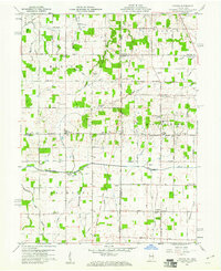
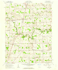
 1961 Osgood1963 Print · USGSThis western Ohio landscape at the start of the sixties reveals a countryside shaped by the historic Treaty Line and the remnants of the canal era. Genealogists can locate numerous rural burial sites like Walkup Cem and St Martins Cem near settlements like Osgood and Willowdell.3 unique versions available
 - 1961 Map of North Star, 1963 Print
 1961 North Star1963 Print · USGSIn the early 1960s, this portion of Darke and Mercer counties remained a strictly agricultural landscape defined by the Greenville Treaty Line. Family researchers can trace ancestral properties near North Star or locate quiet burial grounds like Brock Cem and Holsapple Cem.2 unique versions available
End of results
Showing maps 1-16 of 16
Top cities of Darke County
- Greenville historical maps
- Versailles historical maps
- Arcanum historical maps
- Union City historical maps
- Ansonia historical maps
- New Madison historical maps
See more
Frequently asked questions
- What are the different types of historical maps available for Darke County?
- What is the oldest map of Darke County?
- Where can I purchase historical maps of Darke County for my home or office?
- Where can I download high-res historical maps of Darke County?
- Are there historical topographic maps available for Darke County?
- Is there historical aerial imagery available for Darke County?
- Where are historical maps of Darke County sourced from?