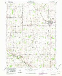
1961 Map of Ansonia
USGS Topo · Published 1983About this map
Ansonia serves as the primary rail hub in this section of western Ohio, where the Conrail lines intersect at the center of the village. The surrounding landscape is defined by a dense grid of rural roads and small crossroads settlements, many established at the intersections of townships like Jackson, Brown, and Greenville. Notable family and community landmarks are scattered across the agrarian terrain, including several rural congregations and their associated burial grounds such as Teegarden Ch and the Old Teegarden Cem.
Find a feature on this map
55 named features on this map. Tap any name to fly to it.
Don’t see what you’re looking for? This feature index may not catch every label — zoom into the map to look around manually.
Map Details
Editions of this 1961 Ansonia Map
2 editions found
Other maps of this area

1908 · St. Henry
USGS Topo · 1:62,500

1915 · Fort Recovery
USGS Topo · 1:48,000

1916 · Winchester
USGS Topo · 1:48,000

1918 · Winchester
USGS Topo · 1:62,500

1918 · Fort Recovery
USGS Topo · 1:62,500

1943 · Winchester
USGS Topo · 1:62,500

1953 · Muncie
USGS Topo · 1:250,000

1956 · Muncie
USGS Topo · 1:250,000

1960 · Union City
USGS Topo · 1:24,000
1960 · Spartanburg
USGS Topo · 1:24,000