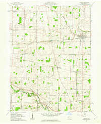
1961 Map of Ansonia
USGS Topo · Published 1962About this map
Ansonia serves as a central hub of activity in this 1961 survey, where the New York Central and Pennsylvania railroads intersect. This transit-oriented layout is reflected throughout the county, with the Baltimore and Ohio railroad cutting across the southern reaches near Coletown. The landscape is a network of small agricultural settlements and corner crossings, including Zumbrum Corners and Hunchberger Corners, alongside community anchors like the Woodland Heights Sch and the Childrens Home.
Find a feature on this map
51 named features on this map. Tap any name to fly to it.
Don’t see what you’re looking for? This feature index may not catch every label — zoom into the map to look around manually.
Map Details
Editions of this 1961 Ansonia Map
2 editions found
Other maps of this area

1908 · St. Henry
USGS Topo · 1:62,500

1915 · Fort Recovery
USGS Topo · 1:48,000

1916 · Winchester
USGS Topo · 1:48,000

1918 · Winchester
USGS Topo · 1:62,500

1918 · Fort Recovery
USGS Topo · 1:62,500

1943 · Winchester
USGS Topo · 1:62,500

1953 · Muncie
USGS Topo · 1:250,000

1956 · Muncie
USGS Topo · 1:250,000

1960 · Union City
USGS Topo · 1:24,000
1960 · Spartanburg
USGS Topo · 1:24,000