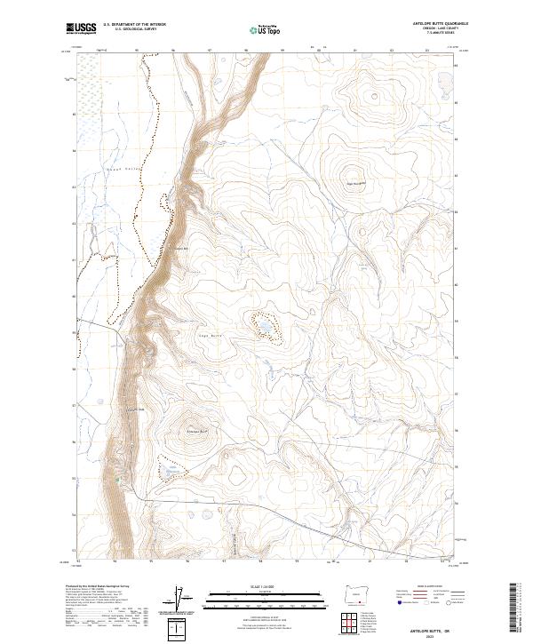
2023 Map of Antelope Butte
USGS Topo · Published 2023About this map
Guano Valley and its prominent Guano Rim dominate this high desert landscape, illustrating a classic basin-and-range topographical structure near the Oregon border. The terrain is characterized by dramatic elevation shifts at sites like Doherty Slide and isolated peaks such as Sage Hen Butte and Antelope Butte. Human presence is sparse, represented primarily by the winding path of Beattys Butte Rd and various water improvements essential for cattle or wildlife in an arid climate. Strategic water sources like Slide Waterhole, Snake Eyes Spring, and Sagebrush Spring serve as the primary landmarks in this expanse. The drainage patterns of Sage Hen Creek and the descent of State Line Canyon define the hydrology of the area, providing a look at the seasonal water systems of Lake County.
Find a feature on this map
18 named features on this map. Tap any name to fly to it.
Don’t see what you’re looking for? This feature index may not catch every label — zoom into the map to look around manually.
Map Details
Editions of this 2023 Antelope Butte Map
This is the sole edition of this map. No revisions or reprints were ever made.
Other maps of this area

1889 · Long Valley
USGS Topo · 1:250,000

1954 · Vya
USGS Topo · 1:250,000

1955 · Adel
USGS Topo · 1:250,000

1957 · Adel
USGS Topo · 1:250,000

1958 · Vya
USGS Topo · 1:250,000

1958 · Adel
USGS Topo · 1:250,000

1962 · Vya
USGS Topo · 1:250,000

1962 · Adel
USGS Topo · 1:250,000

1966 · Catnip Canyon
USGS Topo · 1:24,000
1966 · Rye Creek
USGS Topo · 1:24,000