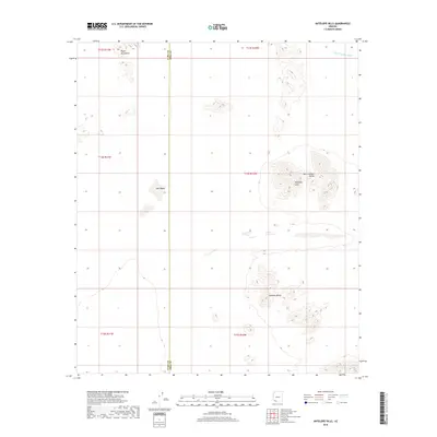
2018 Map of Antelope Hills
USGS Topo · Published 2018About this map
Antelope Hills and the Bryan Mountains anchor this arid landscape within the Sonoran Desert, where the administrative boundary between Yuma County and Pima County cuts a straight line through the terrain. The topography is defined by significant drainage systems and seasonal catchment areas, notably the San Cristobal Wash and the flat, silty expanse of Dos Playas. This 2018 survey illustrates the vast basin-and-range geography of the San Cristobal Valley and the Mohawk Valley, revealing a region shaped by ephemeral water flow and extreme elevation shifts between the valley floors and the isolated mountain peaks.
Find a feature on this map
13 named features on this map. Tap any name to fly to it.
Don’t see what you’re looking for? This feature index may not catch every label — zoom into the map to look around manually.
Map Details
Editions of this 2018 Antelope Hills Map
This is the sole edition of this map. No revisions or reprints were ever made.
Other maps of this area

1953 · Ajo
USGS Topo · 1:250,000

1957 · Ajo
USGS Topo · 1:250,000

1958 · Ajo
USGS Topo · 1:250,000

1962 · Ajo
USGS Topo · 1:250,000

1963 · Ajo
USGS Topo · 1:250,000

1964 · Growler Peak
USGS Topo · 1:62,500
1964 · Agua Dulce Mts
USGS Topo · 1:62,500

1965 · O'Neill Hills
USGS Topo · 1:62,500

1965 · Granite Mountains
USGS Topo · 1:62,500

1967 · Ajo
USGS Topo · 1:250,000