
1965 Map of Granite Mountains
USGS Topo · Published 1966About this map
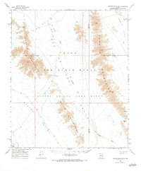
Luke Air Force Range and the Cabeza Prieta Game Range dominate this desert landscape in the mid-1960s, reflecting a period when vast tracts of southwestern Arizona were dedicated to military training and wildlife conservation. The map details a network of drainage systems like the San Cristobal Wash and Growler Wash, which carve through the Lechuguilla Valley and Growler Valley. Human activity is marked by precarious water sources and industrial remnants, including Monreal Well (Dry) and scattered Mines and Ruins in the western reaches. The topography is defined by the sharp elevations of the Mohawk Mountains, Granite Mountains, and Bryan Mountains, showing the isolation and reliance on a few critical points like the Granite Pass Tank (Dry) and intermittent Jeep Trails for navigation.
Find a feature on this map
21 named features on this map. Tap any name to fly to it.
Don’t see what you’re looking for? This feature index may not catch every label — zoom into the map to look around manually.
Map Details
Editions of this 1965 Granite Mountains Map
2 editions found
Other maps of this area

1927 · Aguila Mountains
USGS Topo · 1:48,000

1927 · Kim
USGS Topo · 1:62,500

1930 · Aguila Mountains
USGS Topo · 1:62,500

1931 · Kim
USGS Topo · 1:62,500

1953 · Ajo
USGS Topo · 1:250,000

1957 · Ajo
USGS Topo · 1:250,000

1958 · Ajo
USGS Topo · 1:250,000

1962 · Ajo
USGS Topo · 1:250,000

1963 · Ajo
USGS Topo · 1:250,000

1964 · Growler Peak
USGS Topo · 1:62,500