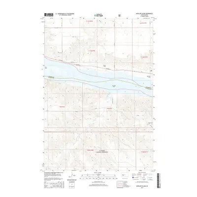
2015 Map of Antelope Island
USGS Topo · Published 2015About this map
Ft. Pierre National Grassland dominates the southern reaches of this landscape, where the rolling plains of Stanley County meet the massive waters of Lake Sharpe. The Missouri River serves as the primary geographic corridor, separating Stanley from Hughes County. This 2015 edition documents the intricate riverine environment, featuring large landmasses within the water like Antelope Island and the eastern edge of Farm Island.
Find a feature on this map
29 named features on this map. Tap any name to fly to it.
Don’t see what you’re looking for? This feature index may not catch every label — zoom into the map to look around manually.
Map Details
Editions of this 2015 Antelope Island Map
This is the sole edition of this map. No revisions or reprints were ever made.
Other maps of this area

1924 · Pierre
USGS Topo · 1:62,500

1934 · Canning
USGS Topo · 1:48,000

1937 · Canning
USGS Topo · 1:62,500

1954 · Pierre
USGS Topo · 1:250,000

1958 · Pierre
USGS Topo · 1:250,000

1967 · Pierre NE
USGS Topo · 1:24,000

1967 · Canning
USGS Topo · 1:24,000
1967 · Canning NW
USGS Topo · 1:24,000

1967 · Ft. George Butte NW
USGS Topo · 1:24,000
1967 · Ft. George Butte
USGS Topo · 1:24,000