
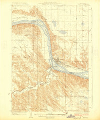
1934 Map of Canning
USGS Topo · Published 1934About this map
The Missouri River cuts a wide path through this 1934 landscape, flanked by a series of river islands including Farm Island, Antelope Island, and Fort George Island. Along the northern banks, the Chicago and Northwestern railroad dictates the placement of riverfront settlements like Canning and Rousseau. The map captures a high density of rural infrastructure, from the Fort Arikara landmark to a network of local education centers like Hensley Sch and Pierce Sch. The southern portion of the sheet is dominated by the Lower Brule Indian Reservation and the Gas Belt, where the terrain transitions into complex drainage systems feeding into the river. Family-named outposts like Seldom Seen Ranch and Joe Fender Ranch suggest the dispersed ranching life of central South Dakota during the mid-1930s, while ecclesiastical sites such as St Thomas Ch and Holy Name Chapel served these isolated communities.
Find a feature on this map
41 named features on this map. Tap any name to fly to it.
Don’t see what you’re looking for? This feature index may not catch every label — zoom into the map to look around manually.
Map Details
Editions of this 1934 Canning Map
This is the sole edition of this map. No revisions or reprints were ever made.
Other maps of this area
1924 · Pierre
USGS Topo · 1:62,500
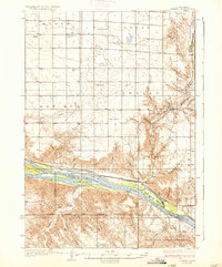
1937 · Canning
USGS Topo · 1:62,500

1953 · Huron
USGS Topo · 1:250,000

1954 · Pierre
USGS Topo · 1:250,000

1954 · Huron
USGS Topo · 1:250,000

1958 · Pierre
USGS Topo · 1:250,000

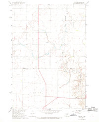
1966 · Joe Creek NW
USGS Topo · 1:24,000

1967 · Pierre NE
USGS Topo · 1:24,000
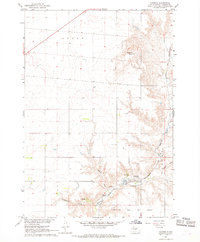
1967 · Canning
USGS Topo · 1:24,000
1967 · Onida SE
USGS Topo · 1:24,000