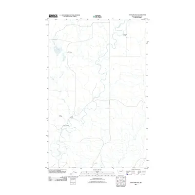
2011 Map of Antelope Pass
USGS Topo · Published 2011About this map
Antelope Pass anchors this remote section of Valley County, Montana, where the drainages of Rock Creek and Willow Creek define a landscape of deeply etched coulees. The map reveals the ranching-driven water management of the early 21st century, most notably at the John Black Number 4 Dam and nearby Lake Grable. These features, along with names like Starbuck Coulee and Riggin Coulee, reflect the family-centric history of land use in this Big Sky region.
Find a feature on this map
13 named features on this map. Tap any name to fly to it.
Don’t see what you’re looking for? This feature index may not catch every label — zoom into the map to look around manually.
Map Details
Editions of this 2011 Antelope Pass Map
This is the sole edition of this map. No revisions or reprints were ever made.
Other maps of this area

1919 · Boundary
USGS Topo · 1:125,000

1954 · Glasgow
USGS Topo · 1:250,000

1957 · Glasgow
USGS Topo · 1:250,000

1958 · Glasgow
USGS Topo · 1:250,000

1984 · Lighthouse Hill
USGS Topo · 1:24,000

1984 · Snake Creek School
USGS Topo · 1:24,000

1984 · Black Calf Reservoir
USGS Topo · 1:24,000

1984 · Opheim
USGS Topo · 1:100,000

1984 · Gay Dam
USGS Topo · 1:24,000

1984 · Last Chance Reservoir
USGS Topo · 1:24,000