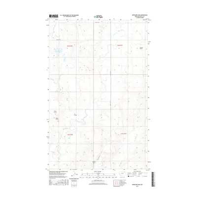
2017 Map of Antelope Pass
USGS Topo · Published 2017About this map
Antelope Pass anchors this 2017 survey of north-central Montana, where the drainages of the Missouri River watershed carve a complex network of coulees and creeks. The landscape is defined by the winding course of Rock Cr and Willow Cr in the east, while Lake Grable stands as a rare permanent water feature in the northwest corner. This area of Valley County exhibits the classic topography of the High Plains, where naming conventions for the terrain reflect early ranching and navigation. Family-named landmarks such as Harry Coulee, Riggin Coulee, and Starbuck Coulee provide essential geographic markers across the township lines of t36n r36e and t35n r37e. Essential travel routes through this sparsely populated territory are preserved via the Hinsdale N Rd and the Rock Creek Trl, tracing the path of least resistance through the rolling breaks.
Find a feature on this map
17 named features on this map. Tap any name to fly to it.
Don’t see what you’re looking for? This feature index may not catch every label — zoom into the map to look around manually.
Map Details
Editions of this 2017 Antelope Pass Map
This is the sole edition of this map. No revisions or reprints were ever made.
Other maps of this area

1919 · Boundary
USGS Topo · 1:125,000

1954 · Glasgow
USGS Topo · 1:250,000

1957 · Glasgow
USGS Topo · 1:250,000

1958 · Glasgow
USGS Topo · 1:250,000

1984 · Lighthouse Hill
USGS Topo · 1:24,000

1984 · Snake Creek School
USGS Topo · 1:24,000

1984 · Black Calf Reservoir
USGS Topo · 1:24,000

1984 · Opheim
USGS Topo · 1:100,000

1984 · Gay Dam
USGS Topo · 1:24,000

1984 · Last Chance Reservoir
USGS Topo · 1:24,000