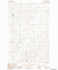
1984 Map of Antelope Pass
USGS Topo · Published 1984About this map
Antelope Pass anchors this high-elevation landscape in Valley County, where the topography is defined by a complex drainage network of creeks and coulees. Surveyed for this 1984 provisional edition, the area demonstrates the intricate watershed of Rock Creek and Deep Creek, which snake through the terrain alongside family-named landmarks like Starbuck Coulee and Jones Coulee. The mapping of Upper Lake and the nearby Ichpair Creek suggests a remote, sparsely settled region where land use was likely tied to seasonal water access and livestock grazing. This survey provides a precise record of the natural contours and seasonal waterways, such as Dry Coulee and Marsh, before more modern alterations to the Montana backcountry.
Find a feature on this map
12 named features on this map. Tap any name to fly to it.
Don’t see what you’re looking for? This feature index may not catch every label — zoom into the map to look around manually.
Map Details
Editions of this 1984 Antelope Pass Map
This is the sole edition of this map. No revisions or reprints were ever made.
Other maps of this area

1919 · Boundary
USGS Topo · 1:125,000

1954 · Glasgow
USGS Topo · 1:250,000

1957 · Glasgow
USGS Topo · 1:250,000

1958 · Glasgow
USGS Topo · 1:250,000

1984 · Lighthouse Hill
USGS Topo · 1:24,000

1984 · Snake Creek School
USGS Topo · 1:24,000

1984 · Black Calf Reservoir
USGS Topo · 1:24,000

1984 · Opheim
USGS Topo · 1:100,000

1984 · Gay Dam
USGS Topo · 1:24,000

1984 · Last Chance Reservoir
USGS Topo · 1:24,000