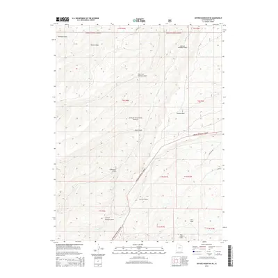
2014 Map of Anthro Mountain NE
USGS Topo · Published 2014About this map
Ashley National Forest covers the high-elevation drainages of this 2014 survey, where the Antelope Cr network has carved a complex system of canyons and draws. The landscape transitions from the north-flowing waters of Brundage Canyon and Nutters Canyon toward the striking geological breaks of the Bad Land Cliffs in the south. The region's industrial and geological character is underscored by names like Gilsonite Draw, referencing the rare hydrocarbon vein deposits found in this part of the Uinta Basin. A few primitive routes, including Co RD 225 and Canyon Fork Rd, navigate the plateaus between deep-cut features such as Fivemile Canyon and Alkali Canyon, illustrating the remote and difficult terrain of the Duchesne County high country during the early 21st century.
Find a feature on this map
24 named features on this map. Tap any name to fly to it.
Don’t see what you’re looking for? This feature index may not catch every label — zoom into the map to look around manually.
Map Details
Editions of this 2014 Anthro Mountain NE Map
This is the sole edition of this map. No revisions or reprints were ever made.
Other maps of this area

1885 · Uinta
USGS Topo · 1:250,000

1886 · Price River
USGS Topo · 1:250,000

1896 · Price River
USGS Topo · 1:250,000

1939 · Duchesne
USGS Topo · 1:125,000

1954 · Salt Lake City
USGS Topo · 1:250,000

1956 · Price
USGS Topo · 1:250,000

1958 · Salt Lake City
USGS Topo · 1:250,000

1960 · Salt Lake City
USGS Topo · 1:250,000

1960 · Price
USGS Topo · 1:250,000

1962 · Price
USGS Topo · 1:250,000