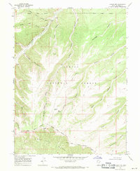
1968 Map of Anthro Mtn
USGS Topo · Published 1971About this map
Ashley National Forest dominates this 1960s landscape, characterized by a complex network of deep canyons and high ridges in the Uintah Basin. The southern portion of the map is defined by the striking Bad Land Cliffs and the historic Old Indian Treaty Boundary, which cuts across the terrain near Anthro Mtn. This area reflects a period of resource management and early geological exploration, evidenced by scattered infrastructure such as a Gaging Sta on North Lost Hollow and isolated industrial markers like a Mine and Drill Hole. The transition from the high forest boundaries to the arid canyon floors at Sowers Canyon and Nutters Canyon highlights the topographic diversity of Duchesne County. Water remains a critical element for local land use, with features like Nutters Spring and several seasonal hollows supporting the sparse network of Pack Trails and wire fences that crisscross the backcountry.
Find a feature on this map
30 named features on this map. Tap any name to fly to it.
Don’t see what you’re looking for? This feature index may not catch every label — zoom into the map to look around manually.
Map Details
Editions of this 1968 Anthro Mtn Map
This is the sole edition of this map. No revisions or reprints were ever made.
Other maps of this area

1885 · Uinta
USGS Topo · 1:250,000

1886 · Price River
USGS Topo · 1:250,000

1896 · Price River
USGS Topo · 1:250,000

1939 · Duchesne
USGS Topo · 1:125,000

1954 · Salt Lake City
USGS Topo · 1:250,000

1956 · Price
USGS Topo · 1:250,000

1958 · Salt Lake City
USGS Topo · 1:250,000

1960 · Salt Lake City
USGS Topo · 1:250,000

1960 · Price
USGS Topo · 1:250,000

1962 · Price
USGS Topo · 1:250,000