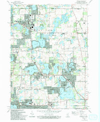
1993 Map of Antioch
USGS Topo · Published 1993About this map
Glacial lakes and modern suburban development converge at the Wisconsin border, where Antioch and Lake Villa serve as central hubs for this watery landscape. The area is defined by its complex hydrology, with large bodies like Loon Lake, Cedar Lake, and Lake Marie interspersed with specialized institutions such as St Benedicts Abbey and the Childrens Home. The Soo Line railroad provides a clear industrial corridor through the western portion of the map, linking established settlements like Lindenhurst to the broader regional network. Locally significant landmarks, including the Gade Landing Strip and numerous specialized schools like the Allendale Farm Sch, indicate a diverse land use pattern that balances residential expansion with rural preserves and lakeside recreation. This 1990s landscape reveals the transition from a seasonal resort area to a year-round suburban community while maintaining large swaths of the County Forest Preserve.
Find a feature on this map
94 named features on this map. Tap any name to fly to it.
Don’t see what you’re looking for? This feature index may not catch every label — zoom into the map to look around manually.
Map Details
Editions of this 1993 Antioch Map
This is the sole edition of this map. No revisions or reprints were ever made.
Other maps of this area

1892 · Racine
USGS Topo · 1:62,500

1893 · Silver Lake
USGS Topo · 1:62,500

1905 · Racine
USGS Topo · 1:62,500

1906 · Silver Lake
USGS Topo · 1:62,500

1906 · Waukegan
USGS Topo · 1:62,500

1908 · Waukegan
USGS Topo · 1:62,500

1920 · Grays Lake
USGS Topo · 1:62,500

1923 · Grays Lake
USGS Topo · 1:62,500

1954 · Rockford
USGS Topo · 1:250,000

1955 · Rockford
USGS Topo · 1:250,000