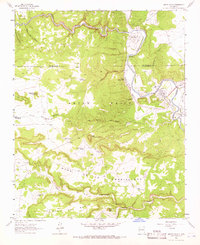
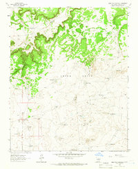
1963 Map of Anton Chico
USGS Topo · Published 1966About this map
The Pecos River carves through a high desert landscape of canyons and mesas in this mid-century survey of the San Miguel and Guadalupe County border. The settlement pattern here is defined by traditional water management, with numerous irrigation channels like the Acequia de Tecolotito, Acequia de los Ranchitos, and Acequia del Hormigoso feeding agricultural life in the valley. These systems are supported by infrastructure such as the Hormigoso Diversion Dam and Tecolotito Diversion Dam.
Find a feature on this map
45 named features on this map. Tap any name to fly to it.
Don’t see what you’re looking for? This feature index may not catch every label — zoom into the map to look around manually.
Map Details
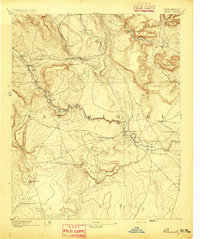
Editions of this 1963 Anton Chico Map
This is the sole edition of this map. No revisions or reprints were ever made.
Other maps of this area

1890 · Bernal
USGS Topo · 1:125,000

1891 · Bernal
USGS Topo · 1:125,000
1894 · Bernal
USGS Topo · 1:125,000

1954 · Santa Fe
USGS Topo · 1:250,000

1958 · Santa Fe
USGS Topo · 1:250,000
1960 · Villanueva
USGS Topo · 1:62,500

1960 · Apache Springs
USGS Topo · 1:62,500
1963 · Thompson Ranch
USGS Topo · 1:24,000
1963 · Mesa Palo Amarillo
USGS Topo · 1:24,000
1963 · Dilia
USGS Topo · 1:24,000