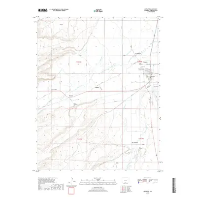
2019 Map of Antonito
USGS Topo · Published 2019About this map
The Conejos County Courthouse stands at the center of a complex network of agricultural and community life in this southern Colorado landscape. Centered on the towns of Antonito and Conejos, the region is defined by an intricate system of hand-managed water rights, with numerous diversions including the Heads Mill Ditch, Guadalupe Ditch, and Manassa Ditch drawing from the Conejos River. These waterways supported the surrounding settlements of Guadalupe, Paisaje, and Mogote. For those tracing local history or family lineage, the map identifies several significant burial grounds, from the Warshaver Cem and Antonito Cem near the town sites to the Mogote Presbyterian Cem and Ortiz Cem further afield. To the south, the Rio San Antonio winds through the valley toward San Antonio and Ortiz, while the Taos Valley Canal highlights the scale of early irrigation efforts in this high-altitude basin.
Find a feature on this map
70 named features on this map. Tap any name to fly to it.
Don’t see what you’re looking for? This feature index may not catch every label — zoom into the map to look around manually.
Map Details
Editions of this 2019 Antonito Map
This is the sole edition of this map. No revisions or reprints were ever made.
Other maps of this area

1918 · Tusas
USGS Topo · 1:125,000

1922 · Conejos
USGS Topo · 1:125,000

1945 · Durango
USGS Topo · 1:250,000

1953 · Durango
USGS Topo · 1:250,000

1954 · Durango
USGS Topo · 1:250,000

1954 · Raton
USGS Topo · 1:250,000

1954 · Trinidad
USGS Topo · 1:250,000

1954 · Aztec
USGS Topo · 1:250,000

1955 · Trinidad
USGS Topo · 1:250,000

1958 · Raton
USGS Topo · 1:250,000