
1954 Map of Aztec
USGS Topo · Published 1975About this map
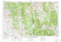
The Continental Divide winds through this mid-century survey of northern New Mexico and southern Colorado, marking the high ground between the San Juan River and the Rio Grande watersheds. This era shows the narrow-gauge Denver & Rio Grande Western RR threading through the mountains, serving high-altitude settlements like Lumberton, Monero, and Amargo. The map documents a complex landscape of land use, where the expansive Jicarilla Apache Indian Reservation and Santa Fe National Forest border traditional farming communities along the Rio Chama. To the south, the archaeological importance of the region is evident in the Chaco Canyon National Monument. The lower Rio Grande valley is dotted with established Spanish-heritage settlements including Abiquiu, Ojo Caliente, and Hernandez, while numerous mesas like Carracas Mesa and Archuleta Mesa define the high desert topography.
Find a feature on this map
160 named features on this map. Tap any name to fly to it.
Don’t see what you’re looking for? This feature index may not catch every label — zoom into the map to look around manually.
Map Details
Editions of this 1954 Aztec Map
4 editions found
Other maps of this area

1883 · Mt. Taylor
USGS Topo · 1:250,000

1886 · Wingate
USGS Topo · 1:250,000

1886 · Mt. Taylor
USGS Topo · 1:250,000

1889 · Largo
USGS Topo · 1:250,000

1889 · Chaco
USGS Topo · 1:250,000

1889 · Santa Fe
USGS Topo · 1:125,000

1890 · Jemes
USGS Topo · 1:125,000

1892 · Jemes
USGS Topo · 1:125,000

1892 · Santa Clara
USGS Topo · 1:125,000

1892 · Wingate
USGS Topo · 1:250,000