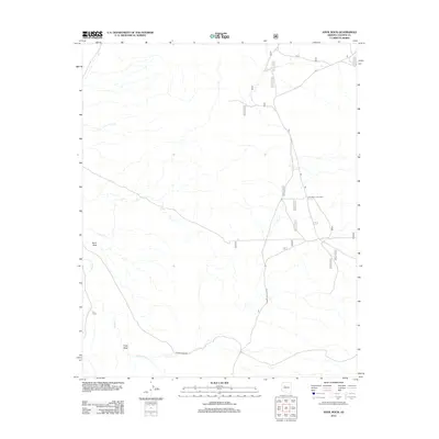
2012 Map of Anvil Rock
USGS Topo · Published 2012About this map
Anvil Rock stands as the primary landmark in this high-desert portion of Yavapai County, where seasonal drainages like Muddy Cr and Hope Wash define the local topography. This 2012 survey documents a sparsely settled region characterized by utility and forestry infrastructure rather than dense residential development. The presence of New Water Line Camp and E L Camp suggests a landscape shaped by resource management and livestock operations. Transport through this arid terrain relies on a network of numbered forestry routes and more substantial corridors such as N Anvil Rock Rd and Forest Service 2 Rd, which connect the scattered outposts across the high plateau. The map illustrates the fundamental relationship between reliable water sources like Muddy Wash and the establishment of temporary or seasonal camps in the Arizona backcountry.
Find a feature on this map
19 named features on this map. Tap any name to fly to it.
Don’t see what you’re looking for? This feature index may not catch every label — zoom into the map to look around manually.
Map Details
Editions of this 2012 Anvil Rock Map
This is the sole edition of this map. No revisions or reprints were ever made.
Other maps of this area

1886 · Diamond Creek
USGS Topo · 1:250,000

1886 · Chino
USGS Topo · 1:250,000

1887 · Prescott
USGS Topo · 1:250,000

1891 · Chino
USGS Topo · 1:250,000

1892 · Diamond Creek
USGS Topo · 1:250,000

1892 · Prescott
USGS Topo · 1:250,000

1923 · Signal
USGS Topo · 1:250,000

1942 · Signal
USGS Topo · 1:250,000

1947 · Turkey Canyon
USGS Topo · 1:62,500

1947 · Camp Wood
USGS Topo · 1:62,500