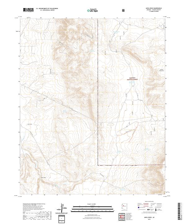
2021 Map of Anvil Rock
USGS Topo · Published 2021About this map
Prescott National Forest land dominates this high-altitude landscape in Yavapai County, where the eastern slopes of the Juniper Mountains meet a network of cattle tanks and forest tracks. The 2021 topography reveals a land managed for water and range, centered around the named settlement of Anvil Rock and the southern cluster of Hope Wash. Vital water sources for livestock and wildlife are scattered across the terrain, including Cole Campbell Tank, Henry Brown Tank, and the Smith and Evans Tank situated near the forest boundary. Historical movement through the area is traced along established corridors such as Anvil Rock Rd, Sidewinder Rd, and Eight Brothers Rd, which navigate the complex drainage systems of Muddy Wash and Muddy Cr. The transition from the National Forest into the surrounding range illustrates the enduring ranching character of this section of the Arizona backcountry.
Find a feature on this map
27 named features on this map. Tap any name to fly to it.
Don’t see what you’re looking for? This feature index may not catch every label — zoom into the map to look around manually.
Map Details
Editions of this 2021 Anvil Rock Map
This is the sole edition of this map. No revisions or reprints were ever made.
Other maps of this area

1886 · Diamond Creek
USGS Topo · 1:250,000

1886 · Chino
USGS Topo · 1:250,000

1887 · Prescott
USGS Topo · 1:250,000

1891 · Chino
USGS Topo · 1:250,000

1892 · Diamond Creek
USGS Topo · 1:250,000

1892 · Prescott
USGS Topo · 1:250,000

1923 · Signal
USGS Topo · 1:250,000

1942 · Signal
USGS Topo · 1:250,000

1947 · Turkey Canyon
USGS Topo · 1:62,500

1947 · Camp Wood
USGS Topo · 1:62,500