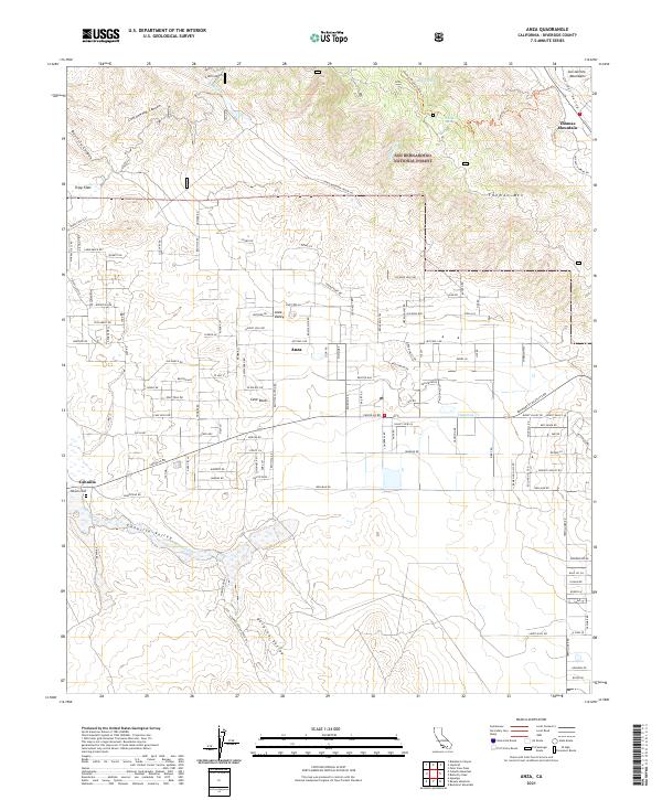
2021 Map of Anza
USGS Topo · Published 2021About this map
Anza Valley serves as the central hub of this high-desert landscape, where the community of Anza sits at the intersection of a sprawling network of local roads and trails. The map detail highlights the area's transition from the flat agricultural and residential expanses of the valley floor to the prominent peaks of the San Jacinto Mountains and Thomas Mountain. To the west, the Bautista Creek Wild and Scenic River carves through Cottonwood Canyon, while the southwest is marked by the historical settlement of Cahuilla and the Cahuilla Valley.
Find a feature on this map
130 named features on this map. Tap any name to fly to it.
Don’t see what you’re looking for? This feature index may not catch every label — zoom into the map to look around manually.
Map Details
Editions of this 2021 Anza Map
This is the sole edition of this map. No revisions or reprints were ever made.