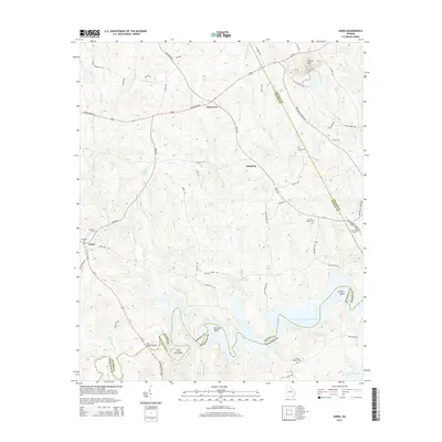
2014 Map of Aonia
USGS Topo · Published 2014About this map
Graves Mtn rises above the rolling terrain of Wilkes County, Georgia, serving as a prominent landmark in a region defined by its rural settlements and the vast reach of the J. Storm Thurmond Reservoir. The map illustrates a landscape of small crossroads communities such as Oak Grove, Adasburg, and Aonia, connected by a network of established routes including Us-378 and Lincolnton RD. Genealogists will find a wealth of local history through numerous family and church burial sites, including the Griffin Johnson Cem near the reservoir and Pierces Chapel Cem. To the south, the irregular shoreline of the Little River is marked by distinctive features like Busseys Bend and Fish Dam Bend, showing the complex interaction between the river system and the county boundaries of Wilkes, Lincoln, and McDuffie.
Find a feature on this map
60 named features on this map. Tap any name to fly to it.
Don’t see what you’re looking for? This feature index may not catch every label — zoom into the map to look around manually.
Map Details
Editions of this 2014 Aonia Map
This is the sole edition of this map. No revisions or reprints were ever made.
Other maps of this area

1892 · Mc Cormick
USGS Topo · 1:125,000

1906 · Crawfordville
USGS Topo · 1:125,000

1912 · Mc Cormick
USGS Topo · 1:125,000

1921 · Appling
USGS Topo · 1:62,500

1943 · Appling
USGS Topo · 1:62,500

1953 · Athens
USGS Topo · 1:250,000

1954 · Metasville
USGS Topo · 1:24,000

1955 · Tignall
USGS Topo · 1:24,000

1958 · Athens
USGS Topo · 1:250,000

1959 · Athens
USGS Topo · 1:250,000