
1954 Map of Metasville
USGS Topo · Published 1955About this map
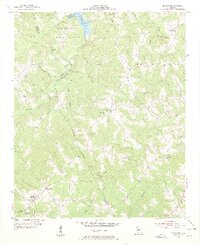
Fishing Creek and its many tributaries carve through the borderlands of Wilkes and Lincoln Counties, creating a landscape defined by small-scale agriculture and rural community life in the mid-1950s. The settlement of Metasville serves as a southern hub, featuring the Metasville High Sch and Metasville Ch. To the north, the newly formed Clark Hill Reservoir pushes into the Clark Hill Reservation, marking a significant shift in local geography as the Savannah River basin was transformed. Away from the water, the map reveals a network of dispersed crossroads and institutions like Sybert, Lovelace, and Harmony Sch. The presence of the Magruda Mines near the center of the sheet indicates the area's geological industrial activity, while numerous family-named landmarks like Curry Hill and various small cemeteries provide essential details for genealogical research.
Find a feature on this map
39 named features on this map. Tap any name to fly to it.
Don’t see what you’re looking for? This feature index may not catch every label — zoom into the map to look around manually.
Map Details
Editions of this 1954 Metasville Map
3 editions found
Other maps of this area

1892 · Mc Cormick
USGS Topo · 1:125,000

1906 · Crawfordville
USGS Topo · 1:125,000

1912 · Mc Cormick
USGS Topo · 1:125,000

1921 · Appling
USGS Topo · 1:62,500

1943 · Appling
USGS Topo · 1:62,500

1953 · Athens
USGS Topo · 1:250,000

1955 · Tignall
USGS Topo · 1:24,000

1955 · Broad
USGS Topo · 1:24,000

1955 · Chennault
USGS Topo · 1:24,000

1958 · Athens
USGS Topo · 1:250,000