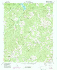
1954 Map of Metasville
USGS Topo · Published 1987About this map
The boundary between Lincoln and Wilkes Counties snakes along the channel of Fishing Creek, marking a landscape of small agricultural settlements and rural institutions in the mid-20th century. At the southern edge, the community of Metasville serves as a local hub, anchored by Metasville Church and the Metasville High School. The terrain is deeply dissected by numerous branches like Gold Mine Branch and Kary Wood Branch, which flow toward the northern reaches of Clarks Hill Lake. Evidence of earlier industrial activity is preserved in the naming of the Magruder Mines and Gold Mine Branch, while the social fabric of the era is visible through scattered schools such as Harmony School and Mt Nebo School, and churches like St Lukes and Anthony. Large portions of the northern terrain are dedicated to the Fishing Creek Wildlife Management Area, preserving the wooded character of the creek basins.
Find a feature on this map
37 named features on this map. Tap any name to fly to it.
Don’t see what you’re looking for? This feature index may not catch every label — zoom into the map to look around manually.
Map Details
Editions of this 1954 Metasville Map
3 editions found
Other maps of this area

1892 · Mc Cormick
USGS Topo · 1:125,000

1906 · Crawfordville
USGS Topo · 1:125,000

1912 · Mc Cormick
USGS Topo · 1:125,000

1921 · Appling
USGS Topo · 1:62,500

1943 · Appling
USGS Topo · 1:62,500

1953 · Athens
USGS Topo · 1:250,000

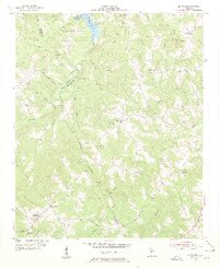
1954 · Metasville
USGS Topo · 1:24,000

1955 · Tignall
USGS Topo · 1:24,000

1955 · Broad
USGS Topo · 1:24,000

1955 · Chennault
USGS Topo · 1:24,000