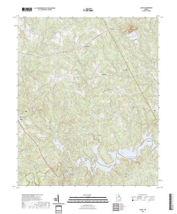
2024 Map of Aonia
USGS Topo · Published 2024About this map
Graves Mountain rises above the rolling terrain where the Little River meets the expansive reaches of the J. Strom Thurmond Reservoir. This landscape is defined by the rural crossroads of Aonia, Adasburg, and Oak Grove, connected by a network of historic routes like Lincolnton Rd and Aonia Rd. The map preserves the locations of several community landmarks, including Pierces Chapel and the Ebenezer Cem, documenting the settlement patterns of Wilkes and Lincoln counties.
Find a feature on this map
60 named features on this map. Tap any name to fly to it.
Don’t see what you’re looking for? This feature index may not catch every label — zoom into the map to look around manually.
Map Details
Editions of this 2024 Aonia Map
This is the sole edition of this map. No revisions or reprints were ever made.
Other maps of this area

1892 · Mc Cormick
USGS Topo · 1:125,000

1906 · Crawfordville
USGS Topo · 1:125,000

1912 · Mc Cormick
USGS Topo · 1:125,000

1921 · Appling
USGS Topo · 1:62,500

1943 · Appling
USGS Topo · 1:62,500

1953 · Athens
USGS Topo · 1:250,000

1954 · Metasville
USGS Topo · 1:24,000

1955 · Tignall
USGS Topo · 1:24,000

1958 · Athens
USGS Topo · 1:250,000

1959 · Athens
USGS Topo · 1:250,000